
By nature I am not an adventurous person. I live with an inexorable inertia pulling me inward toward the familiar, the comfortable. Uncertainty and danger do not tempt or exhilarate me; they turn me aside in exactly the way I am certain evolution means for them to do. Left to my own devices it’s not clear that I would often venture far from my study.
This is why I am so lucky to have married Kate Jenkins. She takes me on adventures.
Despite the gravity that pulls me to my computer, to my house, to my happy and local social circle, Kate and I have stood beside the tallest waterfalls in two different countries, neither of them our own. We have gotten lost on a forested hillside in the Pyrenees. We have wandered through trackless Portuguese countryside with our 1-year-old daughter in a pack-carrier, armed only with bagged lunches and an unclear page of directions leading to the closest town, hours away. We have paddled a canoe for nine days through the Algonquin region of northern Ontario and for six days on the Allagash River in northern Maine. We have ridden on horseback through Iceland and walked a hundred miles across the fields and moors of Scotland.
Kate tends to choose adventures that push the envelope of what our family is capable of, and this latest one was no exception: hiking the Presidential Traverse, a 3+ day hike over 23 miles of trails that lead over seven different 4000’ mountains in the White Mountains of New Hampshire. These mountains include the tallest five: Washington, Adams, Jefferson, Monroe, and Madison, all of whose peaks are 5300’ or more above sea level.
We had planned to do the entire traverse as a family, but Kate injured her back three days before we started. As a result, I took our daughters alone for most of the first two days. Kate was feeling well enough to take the Cog Railway up Mt. Washington, and join us for the latter part of the journey.
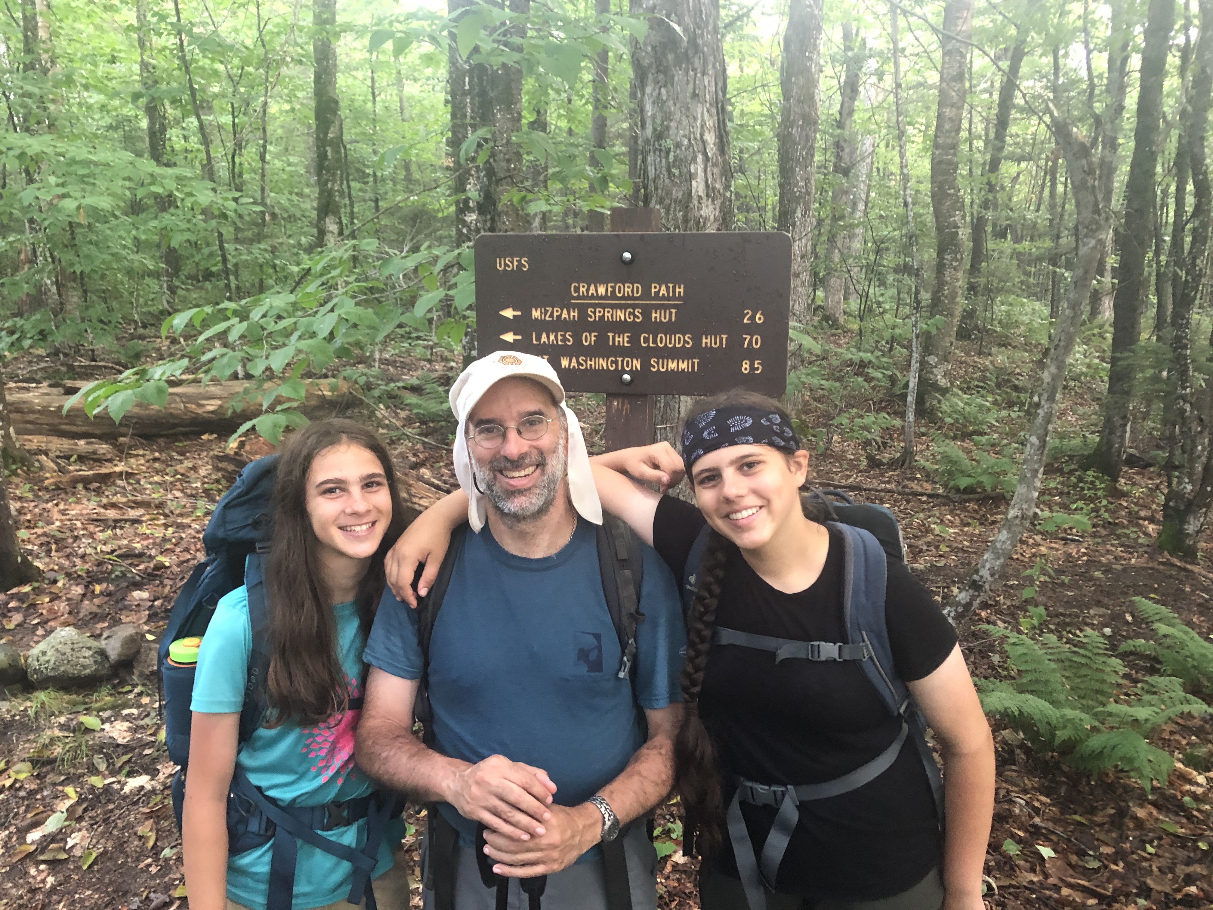
DAY ONE — Appalachia Trailhead to Madison Hut
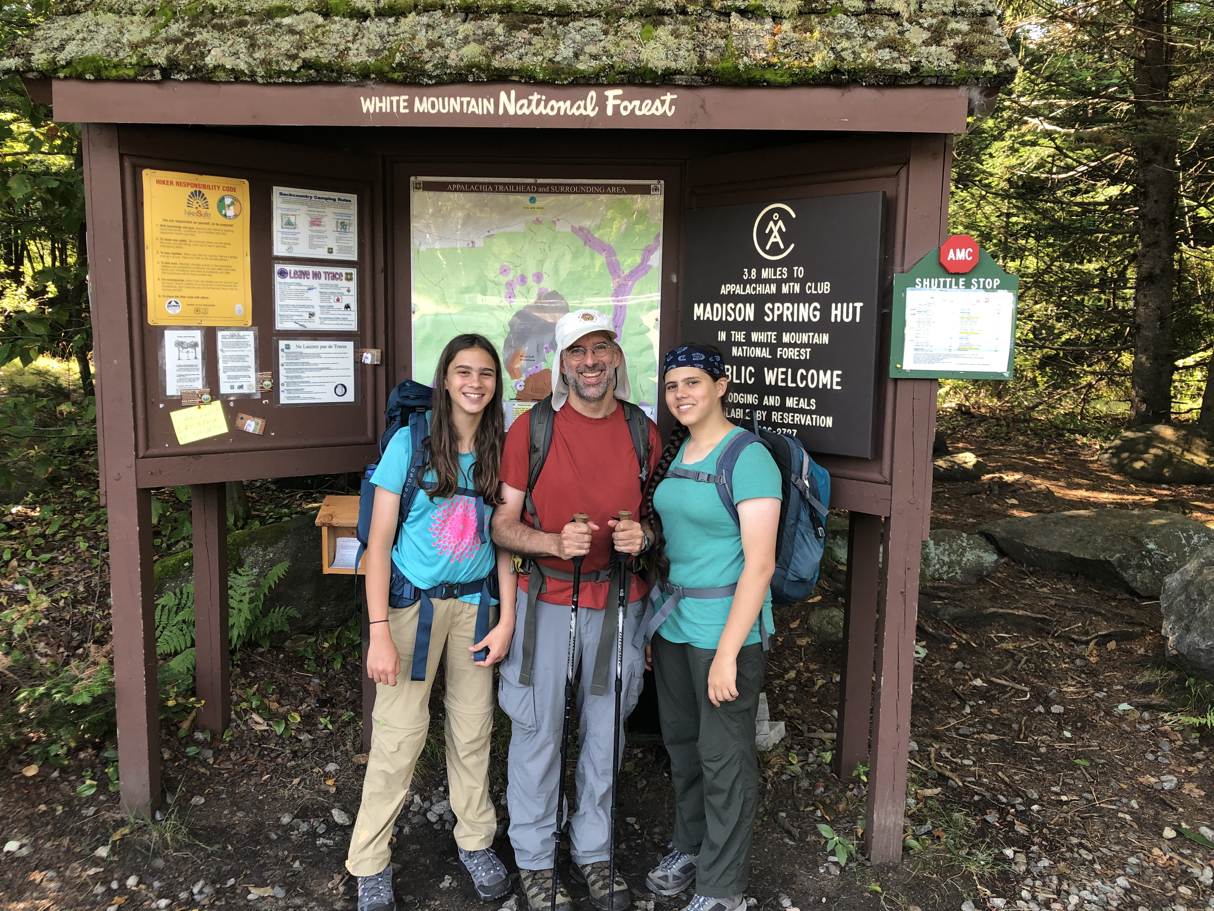
Kate dropped the rest of the family off at the Appalachia trailhead in Randolph. This is the traditional starting block for a southbound Traverse, which is the direction where (if you’re hiking over multiple days) you get most of the hard work out of the way in the earlier sections.
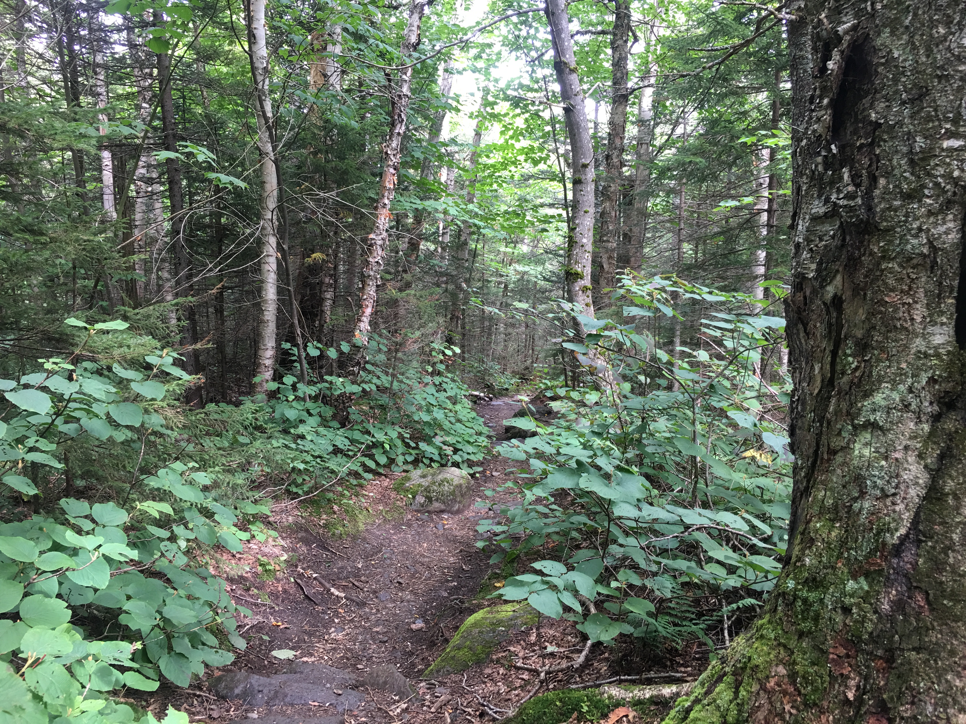
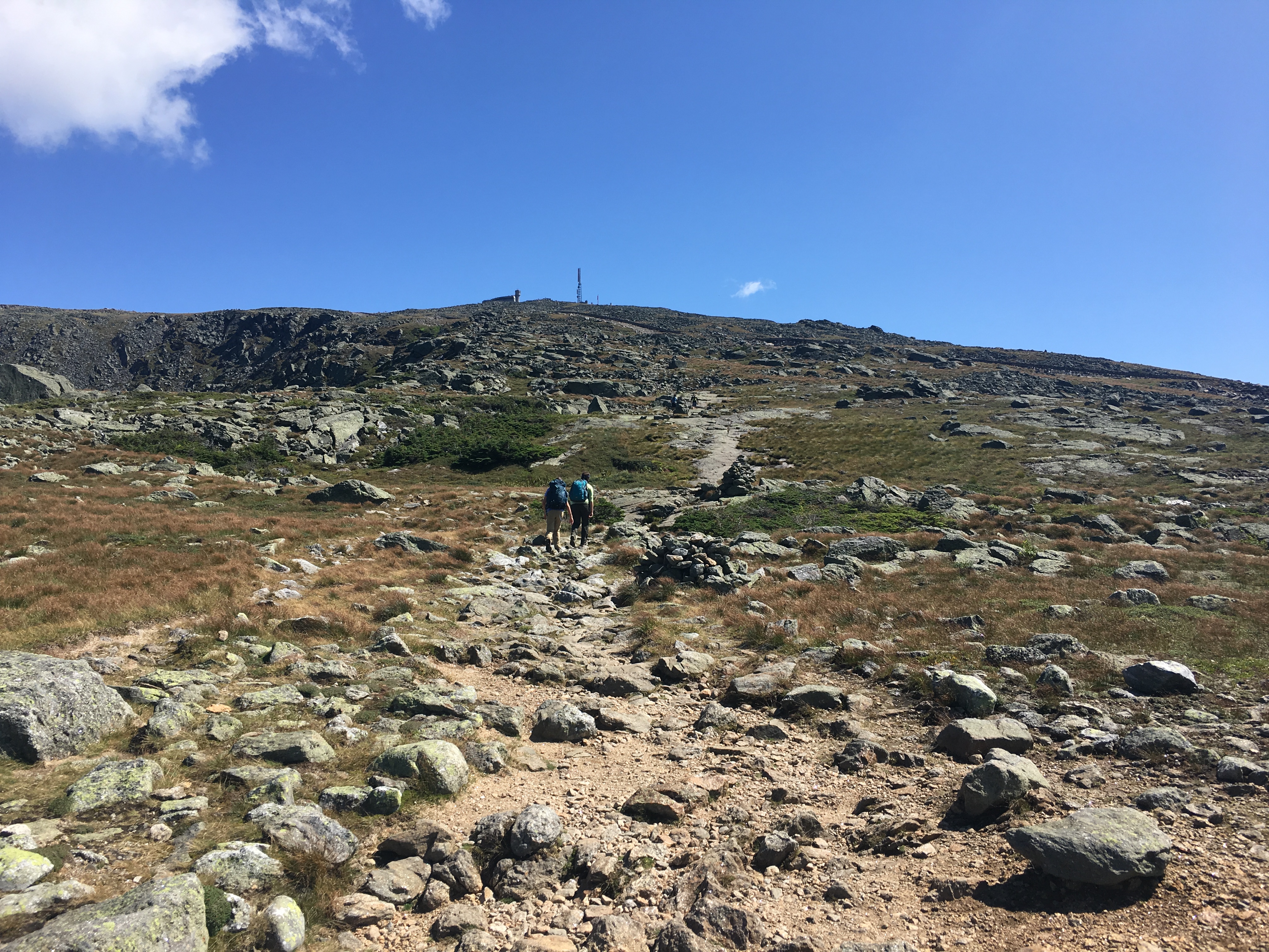
The first leg was short by miles traveled – it’s only 3.8 miles from the highway to the Madison Hut – but you gain a ridiculous 3500’ of elevation in those miles. It’s just up, up, and more up. It was also brutally humid, and by the time we got to the hut, we looked as though we had just climbed out of a swimming pool.
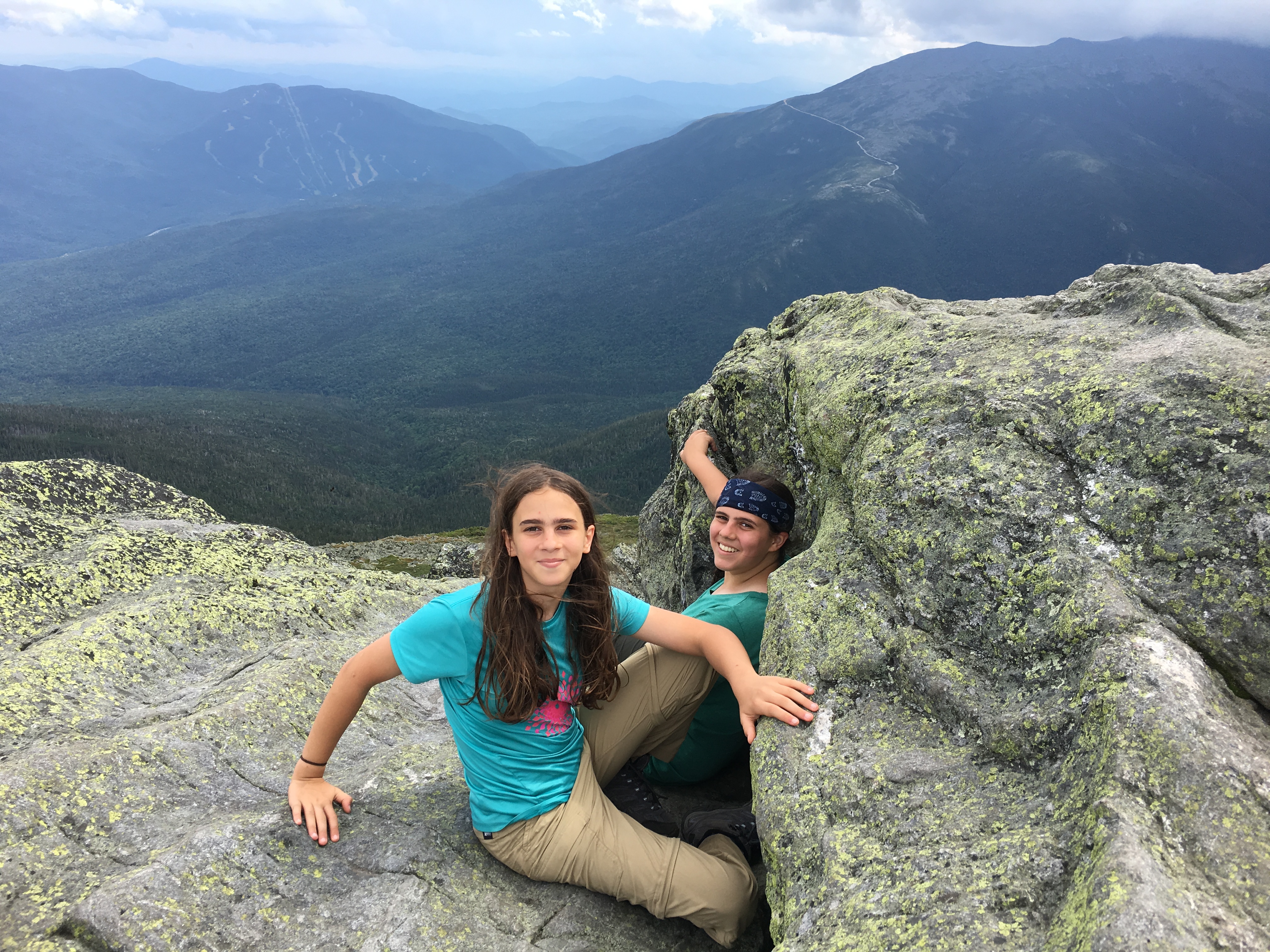
Let me take a moment to say how amazing Elanor and Kira were. They powered up Mt. Madison despite the heat and sweat, and indeed were unflagging and constant for the whole 23 miles. Even better, they took care of each other and of their dad, knowing that Kate, our usual party leader, was absent. Also, there were a large number of slugs basking on the rocks of the trail, and Kira made sure to spot every one of them and point them out so we wouldn’t step on them by accident.

We made good time for all that we sweated our way through 4 collective liters of water and 2 of Gatorade. I thought it would take us 6 or 7 seven hours to reach the Madison Hut, but we finished in 4.5 hours. That gave us plenty of time to hike up to the top of Mt. Madison (5367’) and bag our first peak before heading back down for dinner.
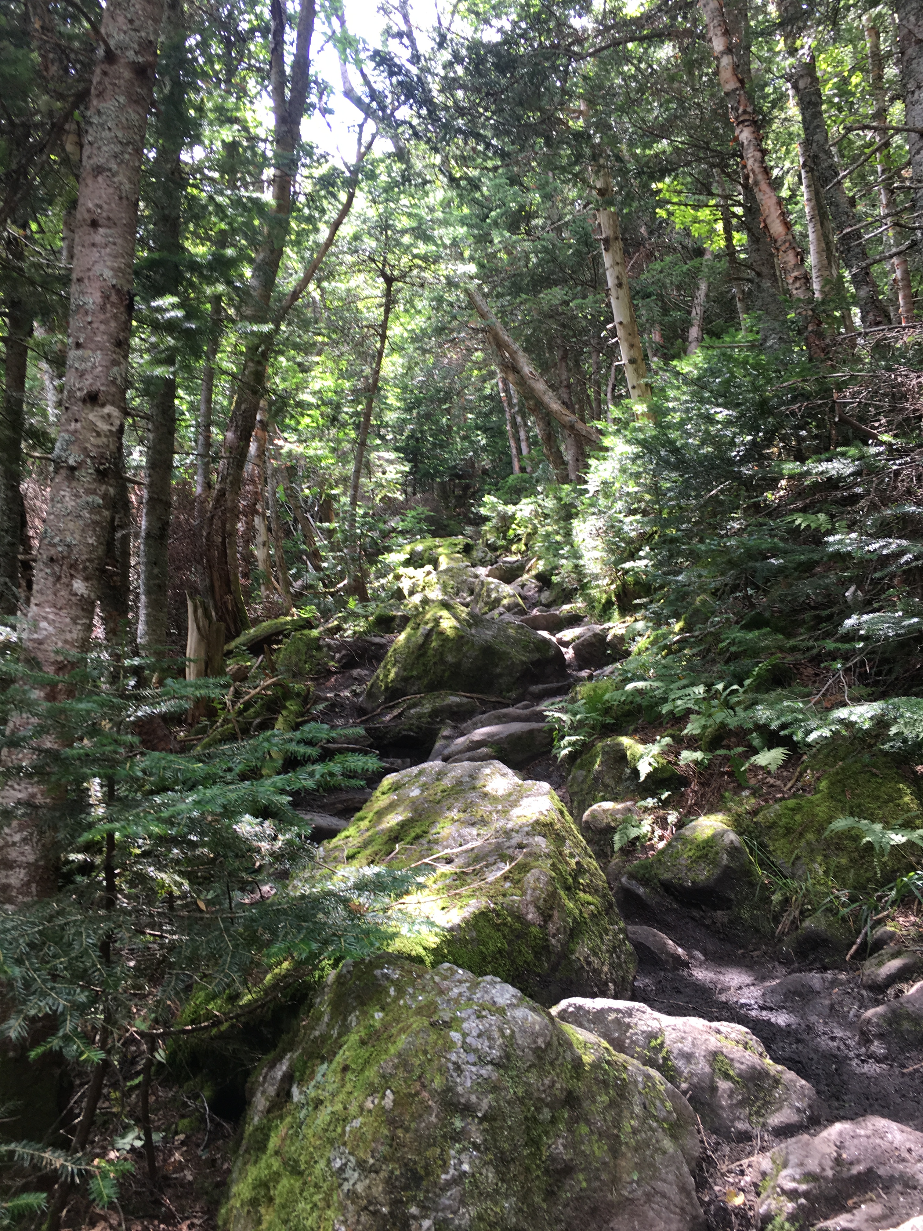
The kids shucked their packs for that last bit, while I carried up water and all our cold-weather and rain gear, just in case. It’s only an additional 0.4 miles from hut to peak, but it adds another 567’ of elevation. That was also the stretch where I learned about the cruel joke that is the “trails” to the peaks of Madison, Adams, and Jefferson.
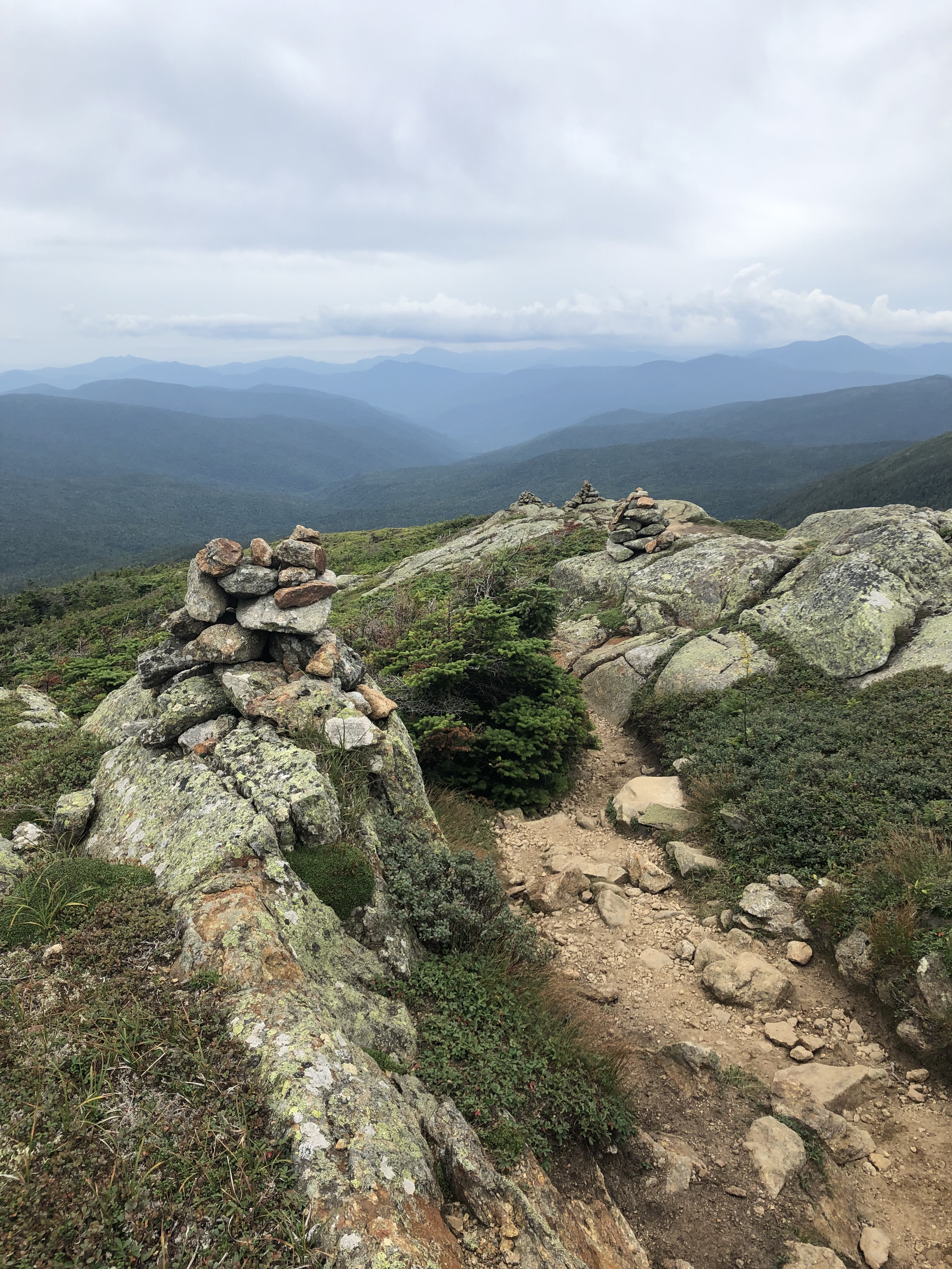
It’s just…boulders. Big piles of boulders. AMC volunteers have thoughtfully built cairns on the slope, and marked some arbitrary-seeming rocks with blazes, but there is no trail per se. There’s only a heap of lichen-covered rocks, generally ranging in size from dorm fridge to industrial fridge, and with each few steps you have to re-map a route to the next cairn. The girls, freed from their packs, bounded up this lithic playground like a pair of mountain goats. Their 50-year-old dad with bad knees picked his way slowly, prodding with his hiking poles like an ant feeling its way with waving antennae.
We were back down to Madison Hut by 3:30, and spent the time until 6:00 dinner resting our legs, playing cards, and chatting with other hikers.
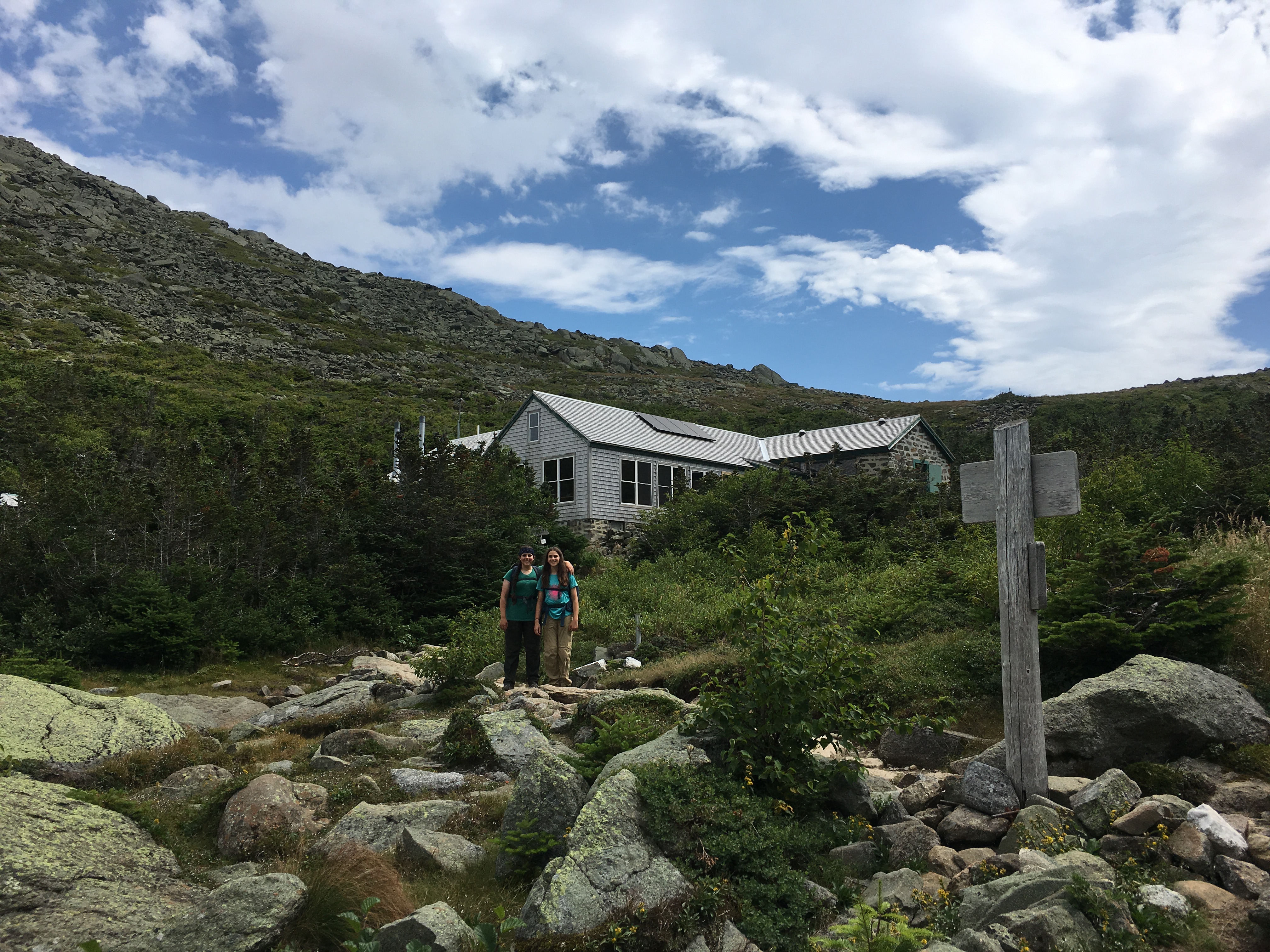
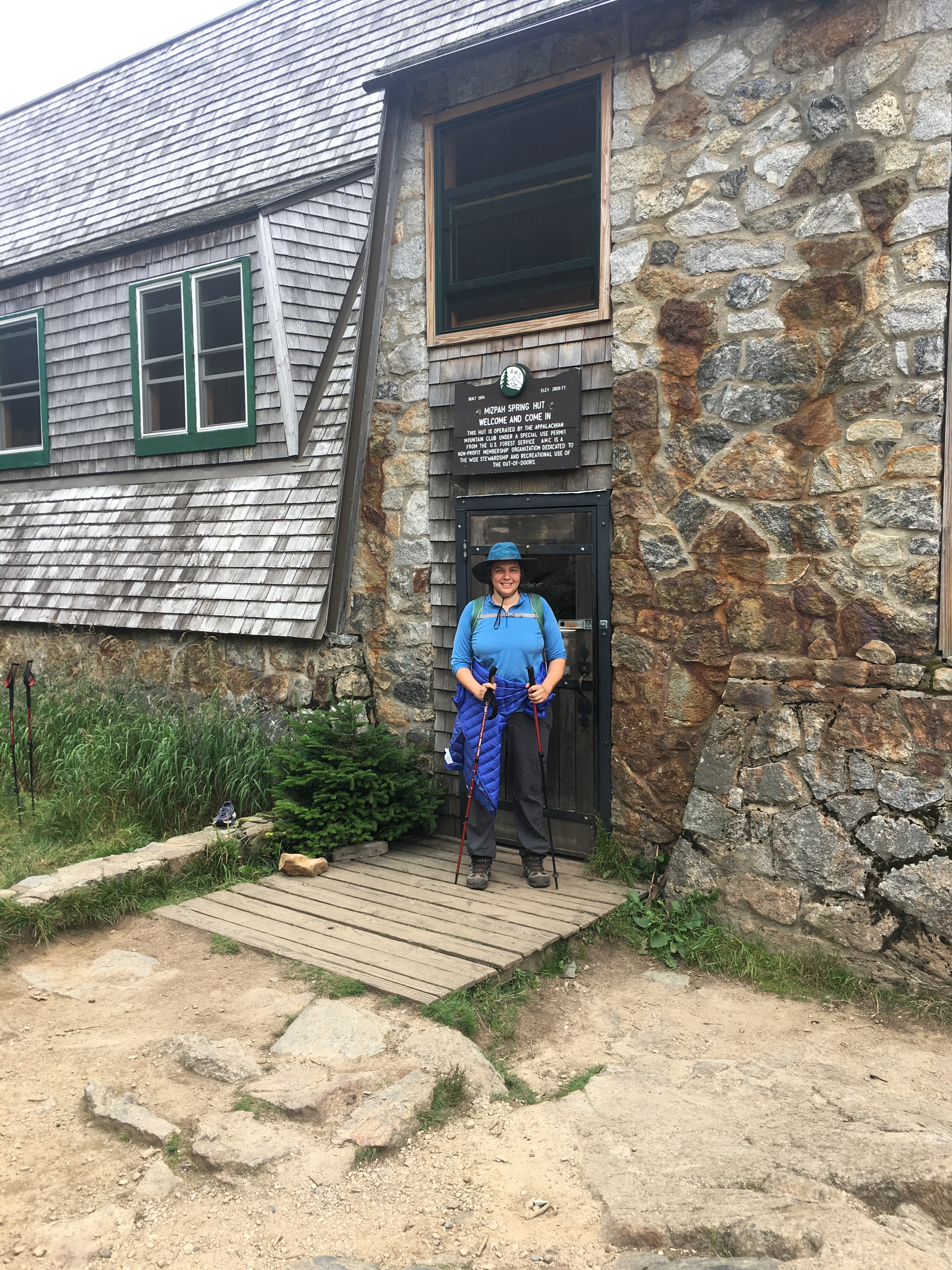
This is a good time to talk a bit about the AMC huts where we spent our three nights in the high places. There are eight of these huts sprinkled around the White Mountains. They provide bunks, blankets, pillows, and sumptuous meals to weary hikers. They also deliver regular weather reports, let you refill water bottles, sell hiking and camping essentials, offer lectures by guest environmental experts, and hold small libraries of nature books and local trail maps. The huts run primarily on solar power, though they have propane tanks for backup. Some heavier essentials, and end-of-season compost, are brought in and out by helicopter.
Each hut is staffed by a crew of five people – typically college students or recent grads. They do all the cooking, preparing delicious five-course breakfasts and dinners for (during the busy season) about 50-90 hungry hikers. More astounding, they have to carry up all the food on pack-boards, and likewise pack out all the trash. They do this twice a week, often returning to their hut each with 40-80 pounds of food on their backs. And though the labor is grueling, the crews are always friendly, helpful, and accommodating to the guests. I can’t recommend the huts enough, if, like us, you’re not quite rugged enough to simply camp outside.

DAY TWO — Madison Hut to Lake of the Clouds Hut
Wake up call in the huts is at 6:30, and breakfast is at 7:00. The morning meal concludes with a skit by the crew, always entertaining, in which they remind you to 1) pack out your trash, 2) re-fold your blankets, and 3) tip generously! We were out on the trail again slightly after 8:00.

Day two of the Traverse is the longest and most arduous. We opted for Maximum Difficulty, since technically you don’t have to go over the peaks of Mt. Adams and Mt. Jefferson, but we wanted to bag all the 4000-footers we could. It’s about a mile to get from the hut to the peak of Adams, but you gain 1000’ feet in that time, so it would be a tough climb even on a normal trail. But as I said, there’s no trail up to Mt. Adams, just a big ol’ pile of stones.


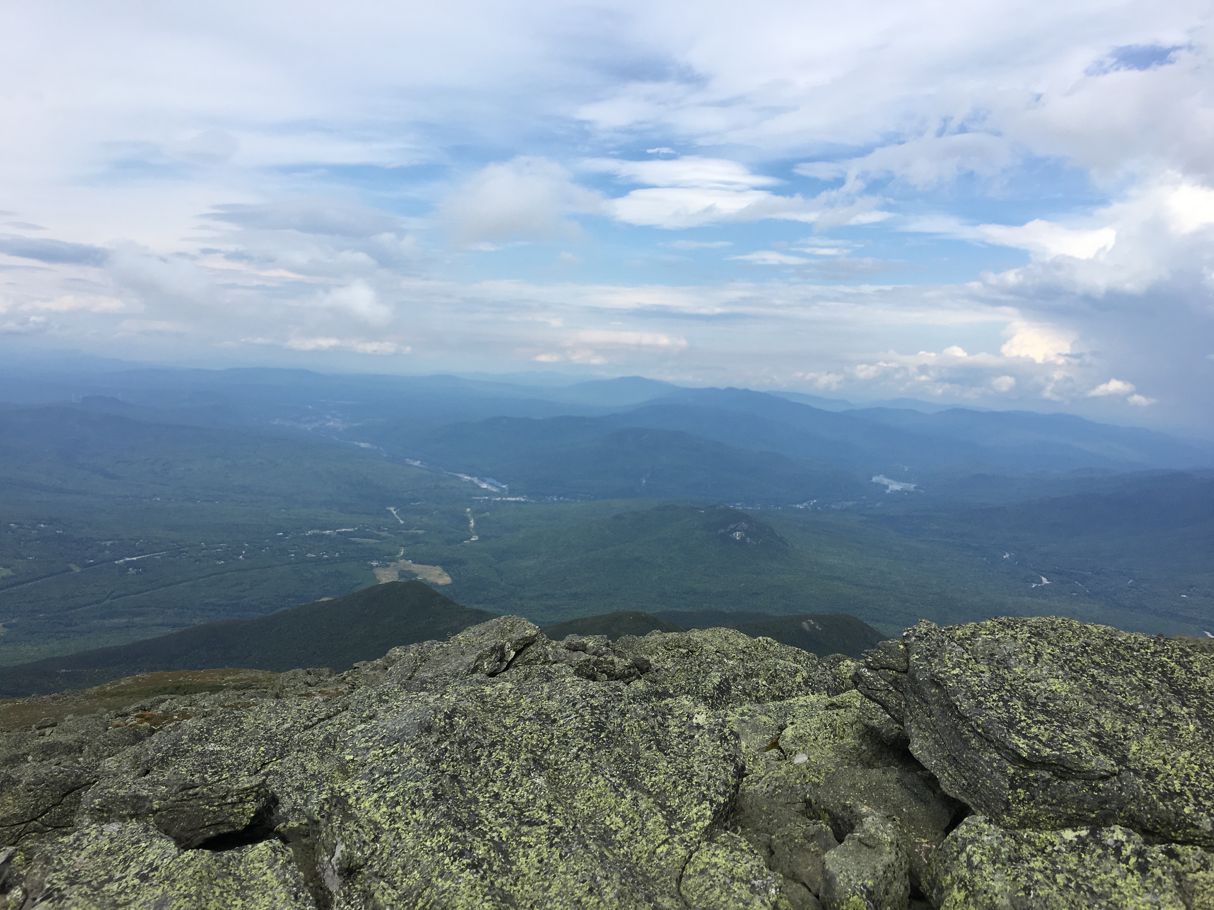
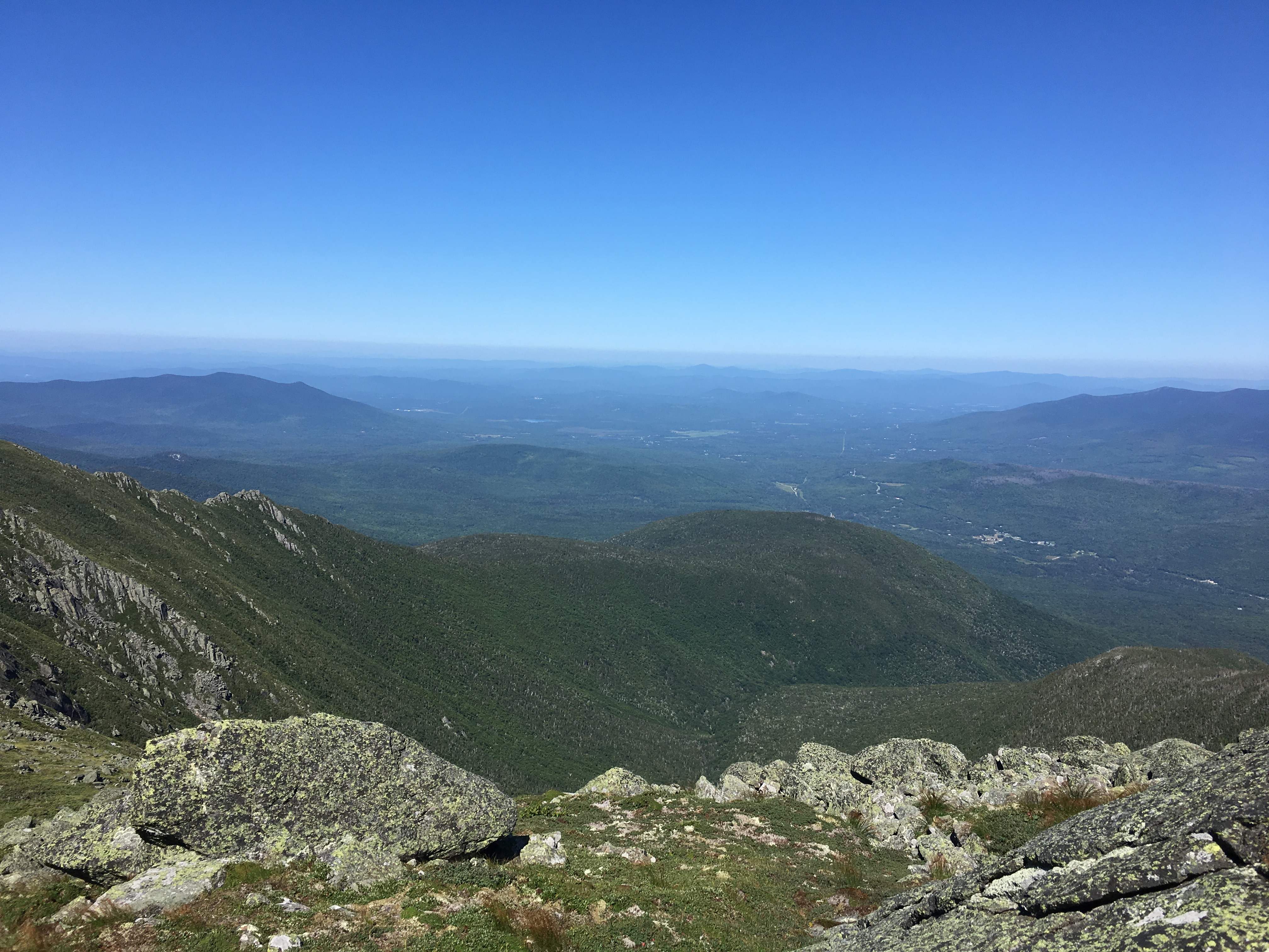
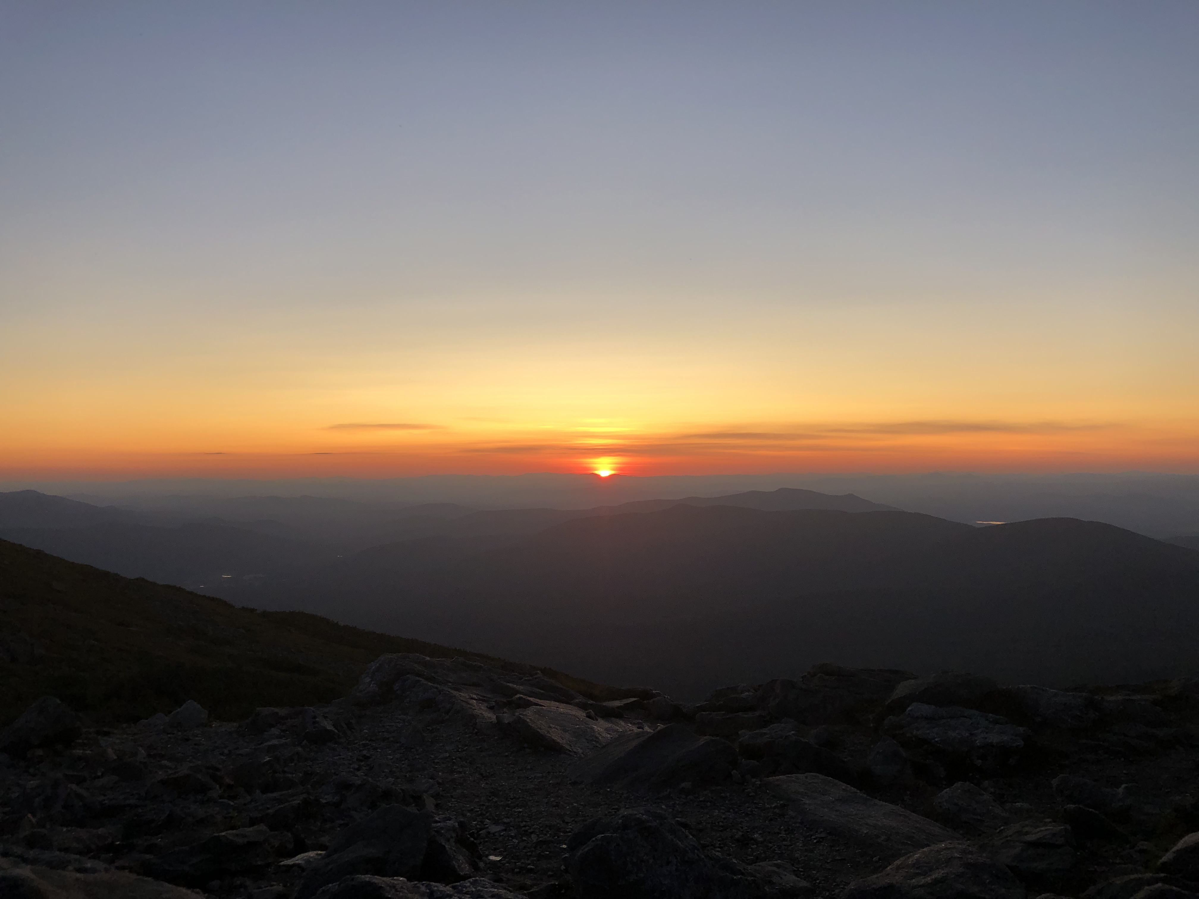
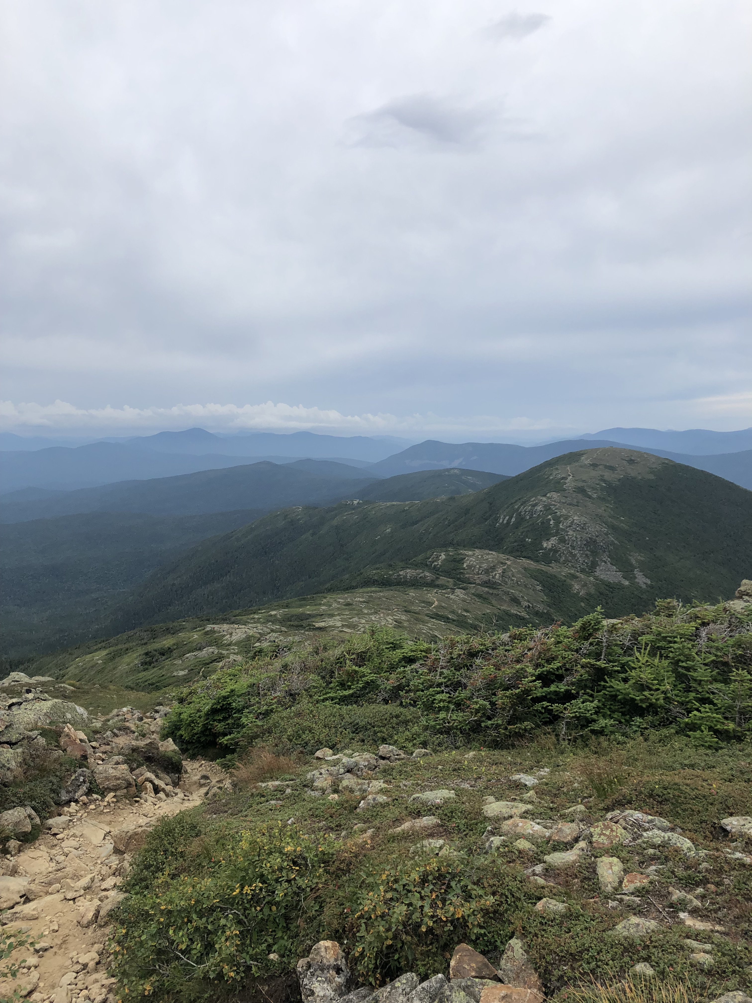
Here’s a brief aside about the weather: Most of the Traverse is above tree-line, and the weather that high up is notoriously unpredictable. The odds of getting a perfectly clear, not-too-cold, rain-free day without strong winds are extremely poor. But that’s exactly what we got on the day we most hoped for good weather: cool, sunny, relatively calm, and with visibility out to 75 miles. My raincoat and warm hat were never used. We were sooooooo lucky!
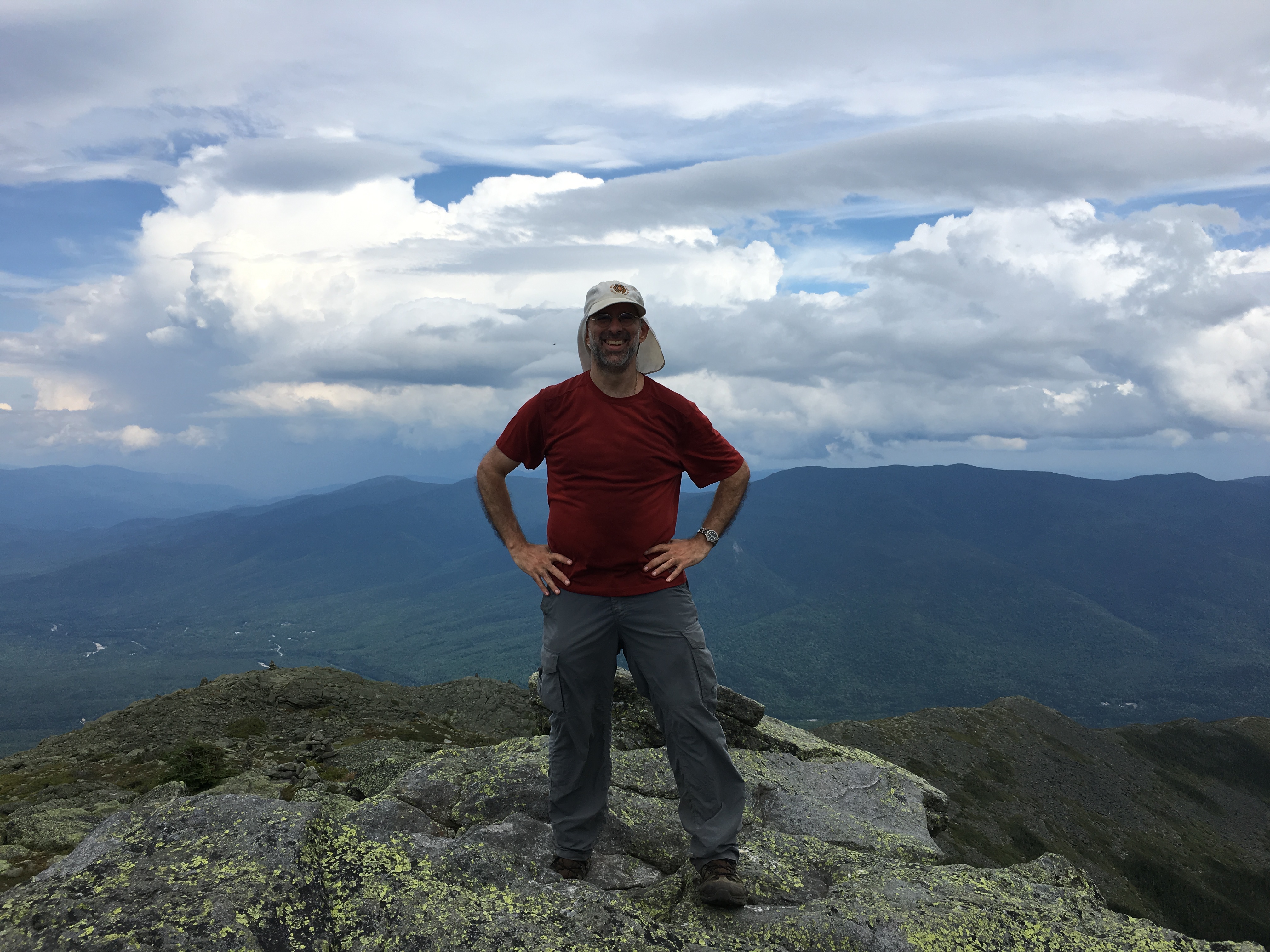
The views from the top of Mt. Adams (5774’) were stunning, as you might guess. We didn’t stay too long, as we had a long way to go and it was quite cold and windy at the summit, but we took some pictures and enjoyed the accomplishment.

After summiting Adams, we dropped down a steep 900’ and then back up nearly as much to reach the top of Mt. Jefferson (5712’). As with Madison, the ascents were strewn with large boulders, and there seldom was a clear trail for us to follow. Once more we enjoyed a few short minutes of celebration for conquering another 4000-footer before continuing on. (We were in a bit of a hurry, because Kate was planning on meeting us around 2:30 at the top of Mt. Washington, and if she wasn’t feeling up to joining us for the next leg, she’d have to take the 3:30 train back down again.)

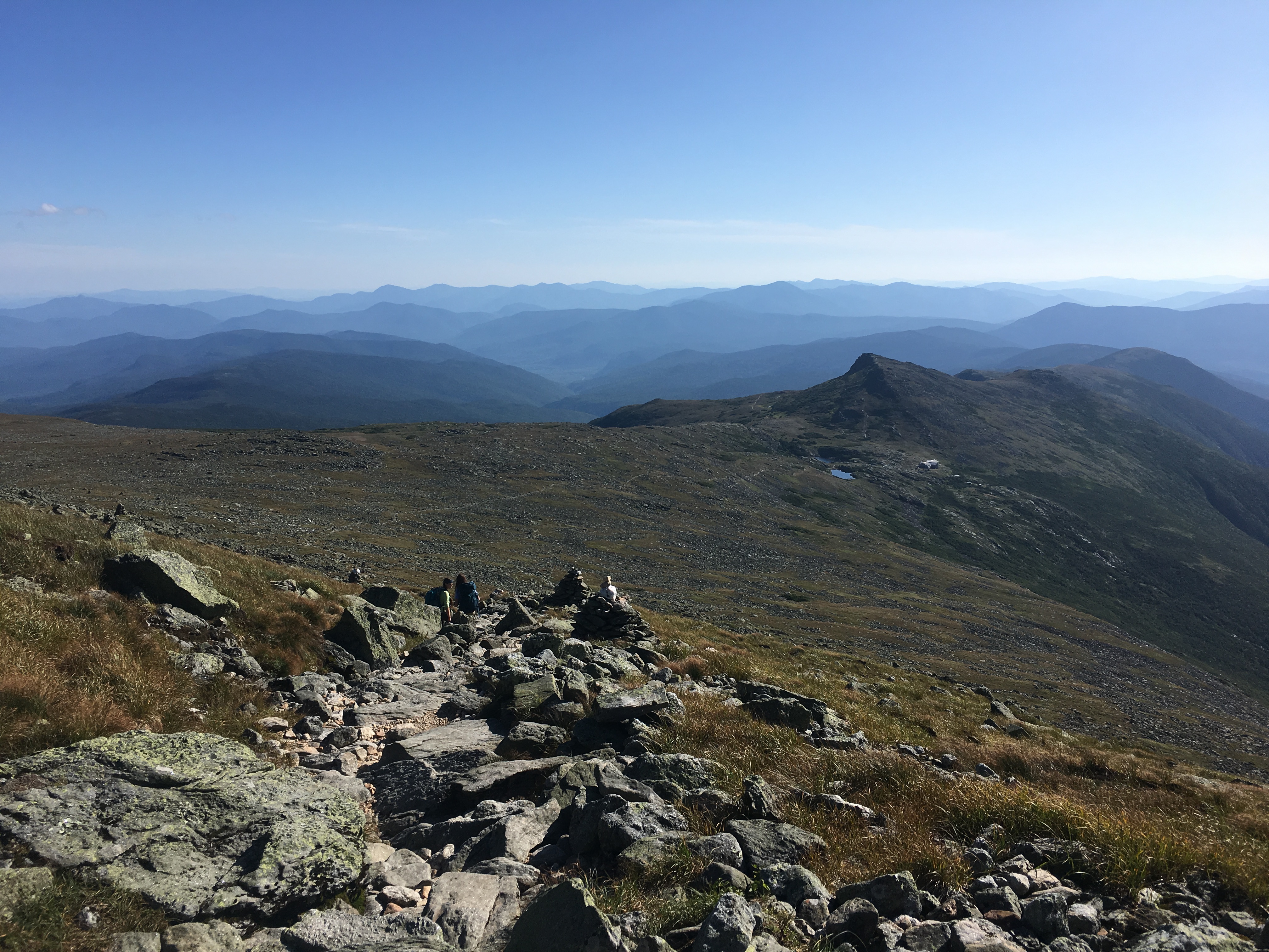
After the drop from Jefferson, it was about 2 more miles and 1400’ of elevation to reach the big one: Mt. Washington (6288’), the tallest mountain in New England. That was the hardest stretch of the Traverse; our legs were already sore and tired from Madison, Adams, and Jefferson. (We opted to skirt the side of Mt. Clay, which lacks the prominence from Washington to be considered a 4000-footer in its own right.)


One can see the weather station atop Mt. Washington from a long distance away, which gives one the (mistaken) impression that one is nearly there – an impression that lasted for about three hours. By lucky chance we neared the cog railway tracks (which the hiking path crosses) very near to when Kate’s train passed by. She saw us waving from the trail!


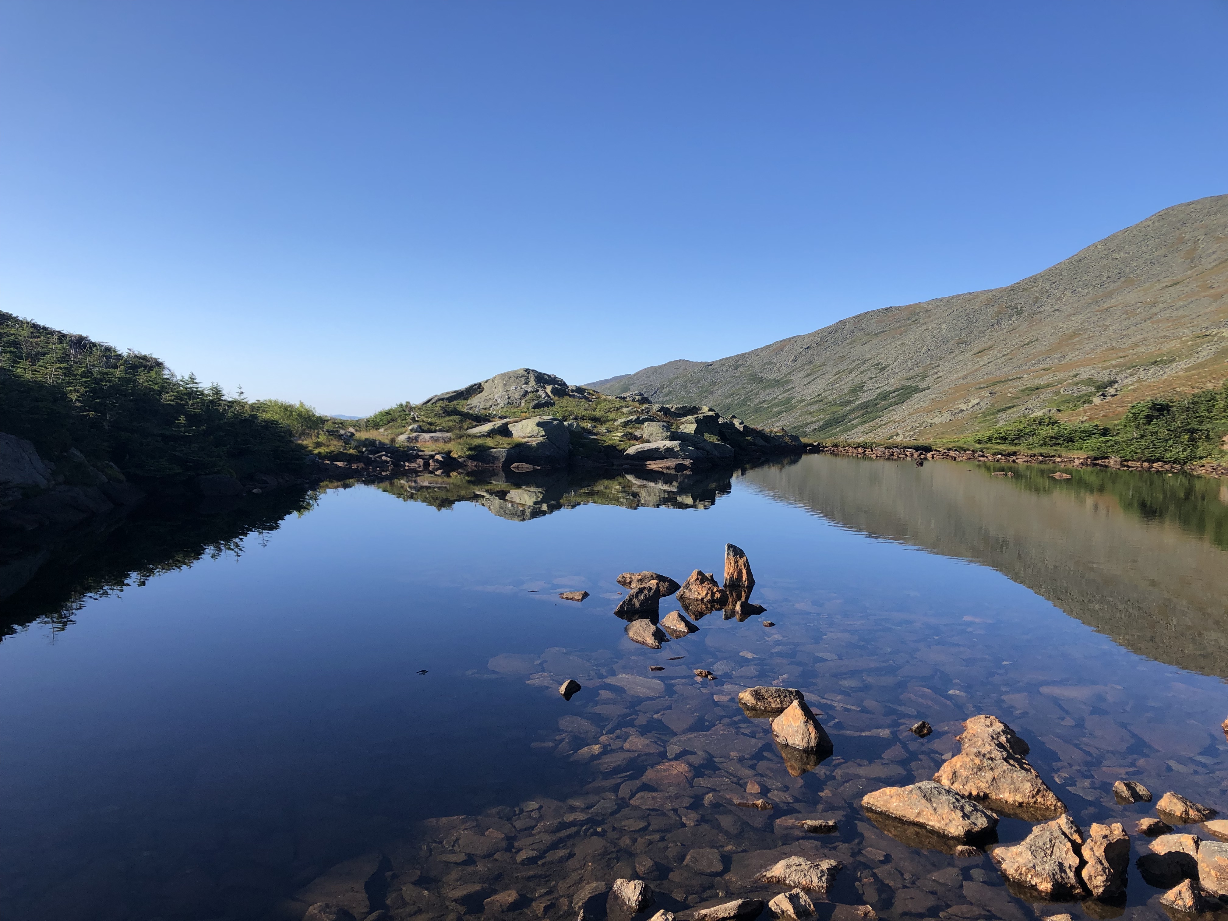
We reached the peak of Washington at 3:00, seven hours after setting out from Madison Hut, and to our great collective joy, there was Kate, waiting for us at the top. We took our picture at the official summit, ate some pizza in the little dining area, and generally felt superior to the masses of tourists who had driven up the auto road or taken the railway. Then the four of us set off down the other side, toward the picturesque Lake of the Clouds Hut 1.5 miles away. We arrived at 5:40, a mere 20 minutes ahead of dinner, after a nine-hour day of grueling hiking.
I have never been as excited for a meal as I was for the dinner we ate that night at Lake of the Clouds.
After dinner we enjoyed a wonderful presentation by a Christoph Geiss, a professor of environmental science at Trinity College, on how glaciers carved out the valleys of the White Mountains as they retreated back to Canada. Afterward he set up a telescope that allowed viewers to see Jupiter (along with a few of its moons) and Saturn (complete with rings). The night sky was clear enough to show the smear of the Milky Way.
Around 10:00, having spent the day picking my way over countless rocks, I slept like one.

DAY THREE — Lake of the Clouds Hut to Mizpah Spring Hut
We started early – 7:45am – because the weather forecast called for rain around mid-day, and we’d heard that the final half-mile involved a very steep descent that would become hellish if the rocks were wet.
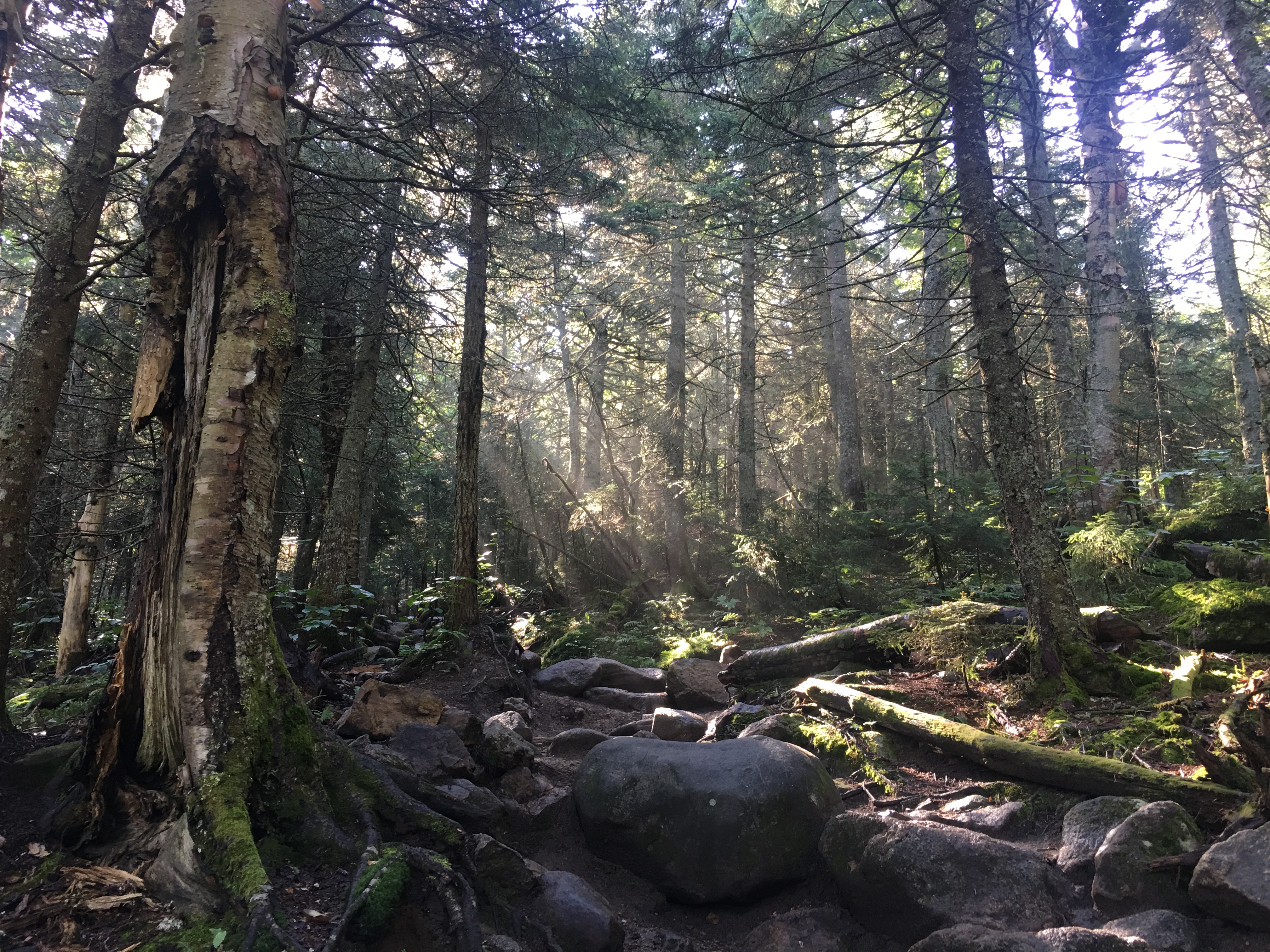
We began with a quick trip up Mt. Monroe, which rises about 400 feet above Lake of the Clouds. It only took us about half an hour, if that. The trail, while rocky, was an actual thing, and not an amorphous sea of boulders.


After that we hit three more peaks —Franklin, Eisenhower, and Pierce—as the trail steadily lost elevation between each pair of mountains. (Franklin, like Clay, doesn’t count as an official 4000-footer. It’s too close to Monroe.) I had planned on skipping Eisenhower, since the whole family had climbed it as a day hike a few years ago, but Kate and Elanor were keen to go over it.


As much as I enjoyed the scenery, I was quite keen on arriving at Mizpah Hut ahead of the rain, so I exhorted the family not to dawdle too much. The final half-mile drops about 500’ in a series of steep rocky slopes, which was not my knees’ favorite part of the Traverse, but we made it to the hut about ten minutes before the rain started. Perfect timing!
DAY FOUR — Mizpah Spring Hut to Route 302
Our Traverse effectively ended the previous day, since, with a shuttle to catch, we chose to eschew the final possible 4000-footer (Mt. Jackson) and simply take the straight line trail back to the road. As such, we finished with a leisurely 2.5 mile descent from the Mizpah Hut to Route 302, arriving at ground level well before noon. The report from my knees was that this was just as well, given the rigors I had put them through. Also, I’m sure my kidneys appreciated that I wouldn’t need another day of gulping down Naproxen to soothe my various aches and pains.

My absolute kick-ass daughters still had energy to spare as we waited for the shuttle at the Highland Center in Crawford Notch. They could have spent a fourth day climbing up and down mountains, but for now, we’ll have to wait on continuing to knock 4000-footers off our list.
Aside from the expected feelings of exhilaration and exhaustion, I was left feeling like I wanted to keep conquering mountains, but that I have no great desire to see the boulders of Madison, Adams, and Jefferson again. (I’d take the views, though!) I still have plenty of hiking ahead of me, having only reached the top of 13 out of the 48 4000-footers of New Hampshire, but among those 13 are the 7 highest – all the 5000-footers on the list. (Washington, Adams, Jefferson, Madison, Monroe, Lafayette, and Lincoln.)
I will leave you with this map of our route, with our path marked in blue. (Note that Mt. Clinton has since be renamed to Mt. Pierce.)

