
This is the account of our holiday in France and Spain. It covers the “long days of hiking” portion of the trip, as we walked from Collioure, France to Port de la Selva, Spain.
April 25/26 – Boston -> Philadelphia -> Barcelona -> Cerbere -> Collioure
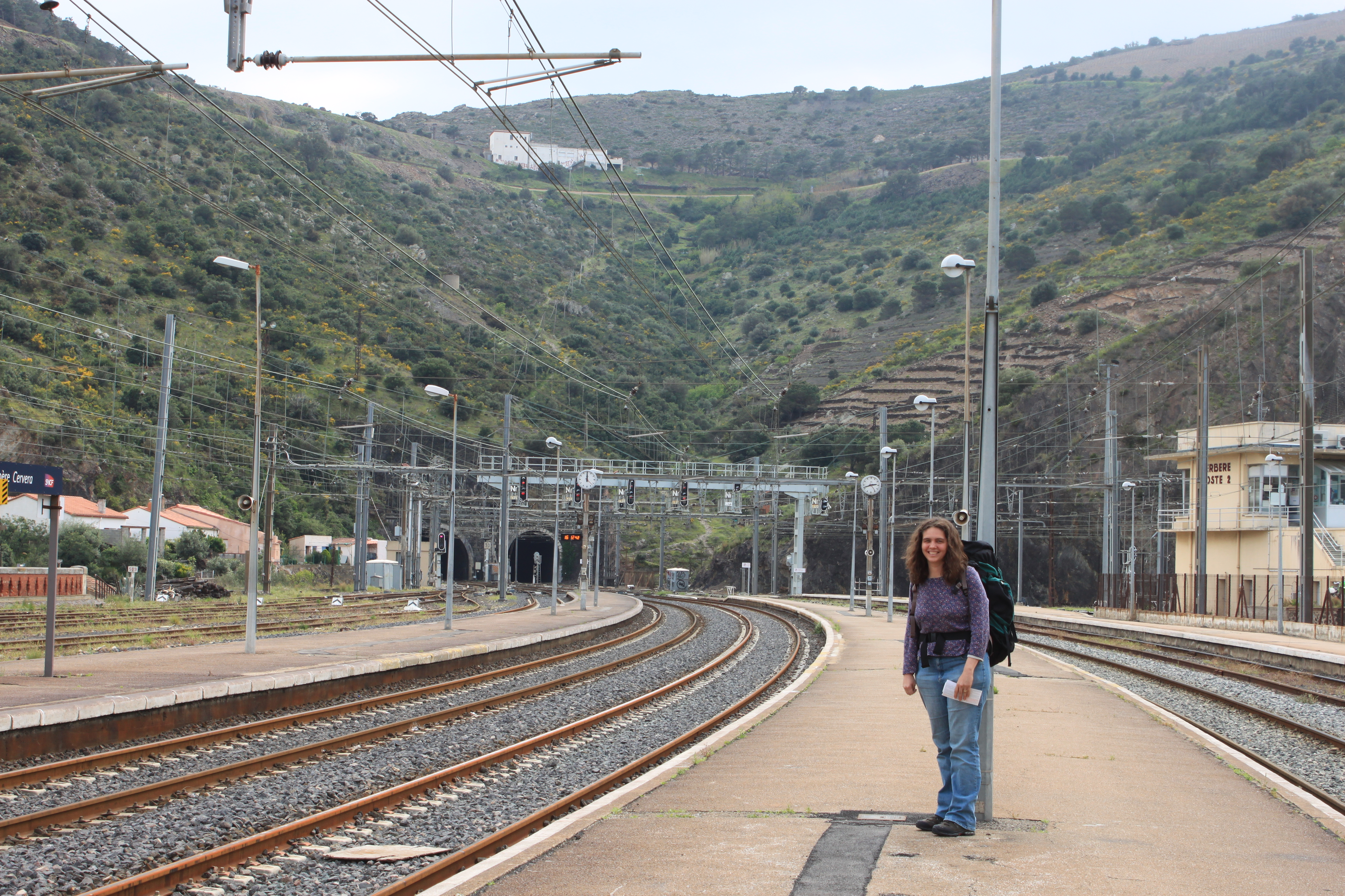
The first day (two days, if you consider the time-zone shift) featured an unavoidable series of airplanes and trains as we made our way from Boston to the small French town of Collioure (pop. 3000) near the Spanish border. U.S.Airways gave us some unwanted tension as our flight out of Boston was delayed by “hot brakes,” and then my large rucksack was temporarily AWOL in Barcelona, but after that our travels were straightforward. Two trains took us from Barcelona to Collioure, France via the border town of Cerbere. (France and Spain use different rail gauges, so Cerbere is a common point of transfer.)
(Note: all photos can be clicked to expand. For the landscapes especially, it’s worth it for the extra detail!) This first portion of our vacation is called “The Walk” because we had a planned five days of hiking ahead, during which we would make our way southward from Collioure to the Spanish town of Port de la Selva along the Vermilion Coast. An outfit called Sherpa Expeditions had arranged hotels for us in each port o’ call, as well as for the bulk of our luggage to be carried ahead of us each day. Most importantly, they provided maps and directions for our cross-country journeys.
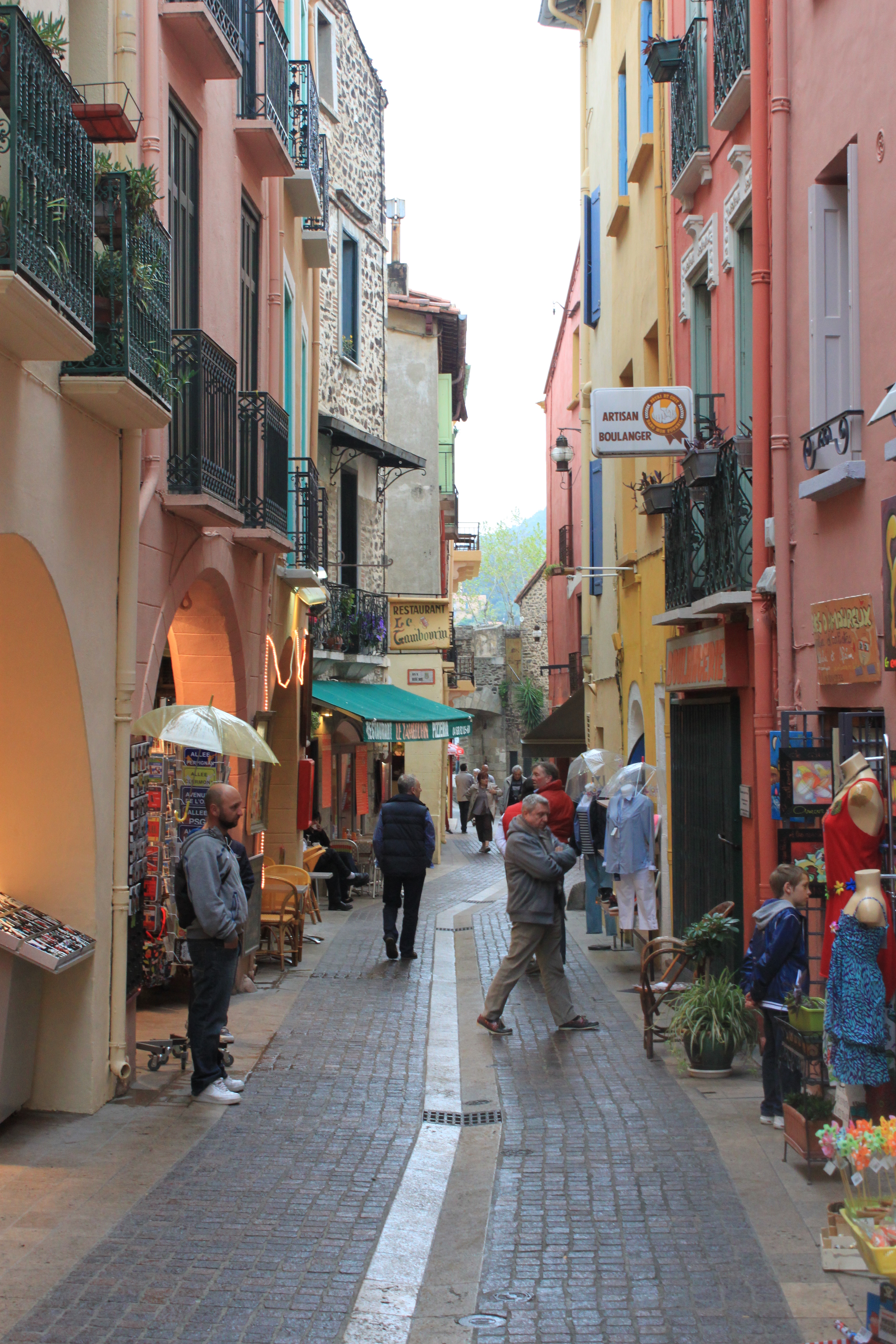
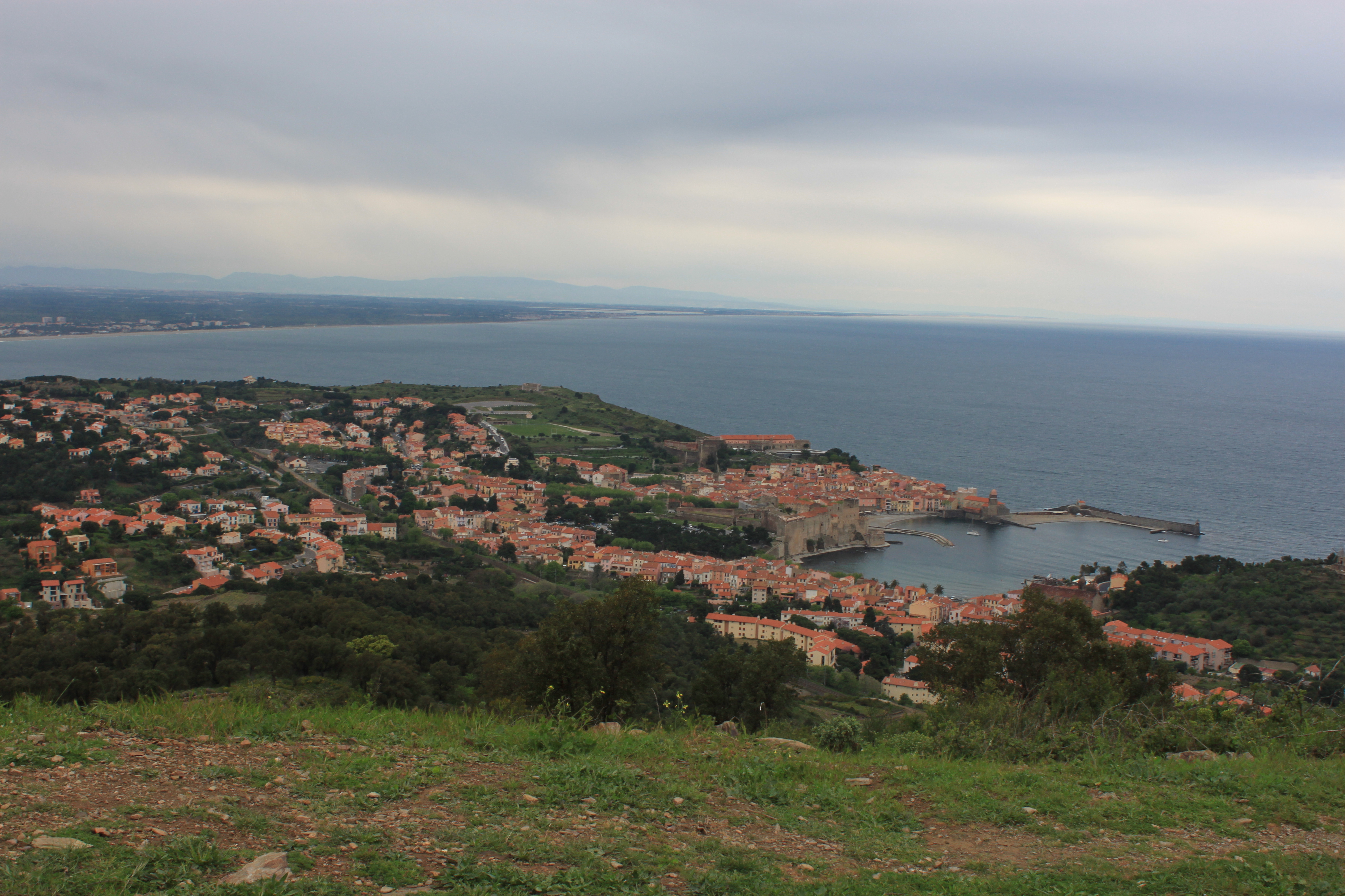
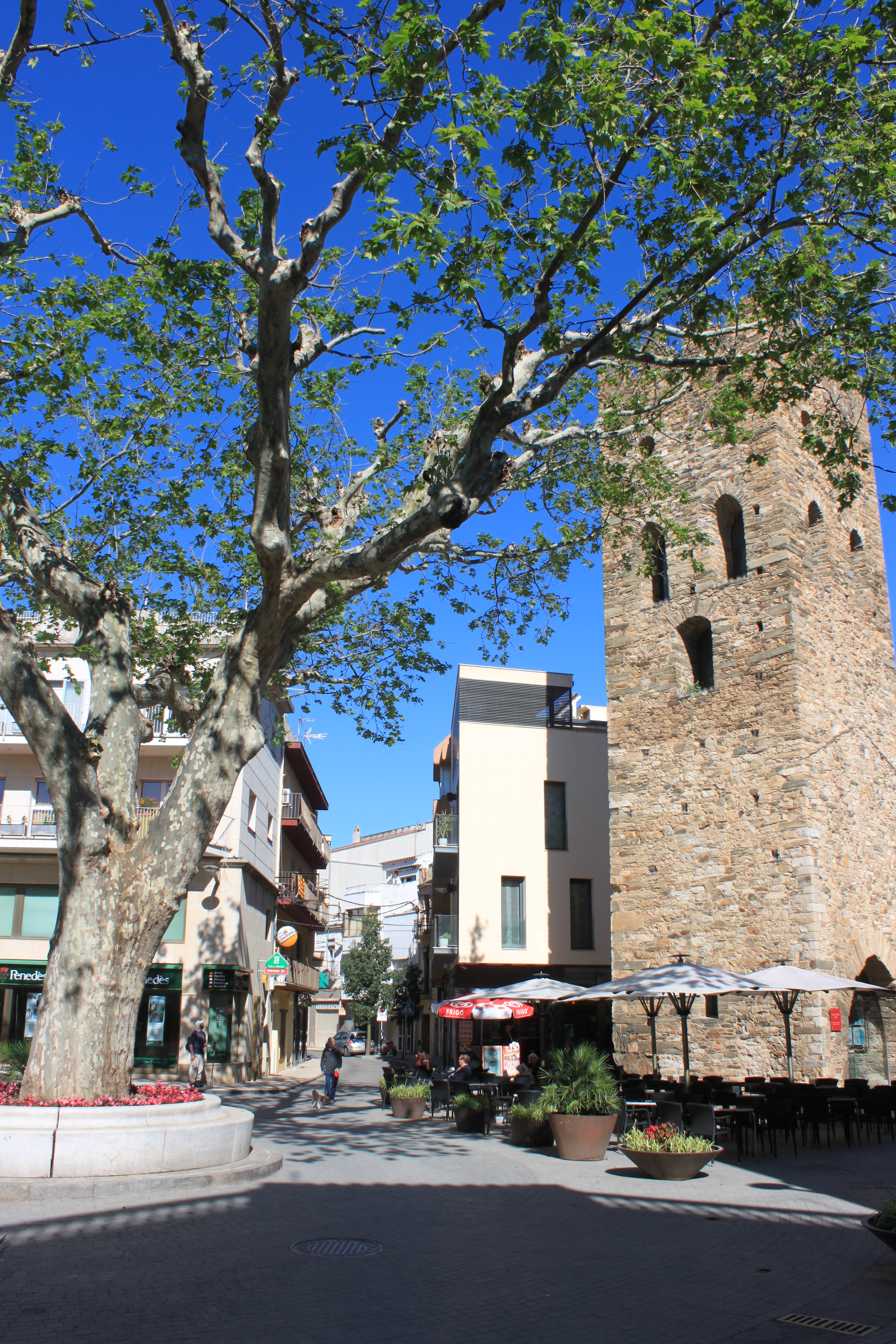
In Collioure, our hotel was “Les Templiers,” a tiny vertical place with an elevator barely large enough to accommodate Kate and I and our two large rucksacks. (Speaking of which: to get to the hotel, you had to go through the bar and out the back to a smaller street. I got myself wedged in the exit door, trying to pass through with my pack on, silly American that I am.) Our room itself was about 10′ x 10′, but plenty nice for our minimal needs. After dropping off our stuff, we wandered about Collioure for a bit, fighting off jet-lag until dinner at a local restaurant. Back at the hotel we FaceTime’d with the kids, and found that my mom and stepfather had managed to fend off anarchy for at least the first 18 hours of our absence.

April 27 –Collioure -> La Valle -> Collioure
This was supposed to be the first day of a five day, forty mile hike, from Collioure to Port de la Selva.


As the well-worn saying goes, “The best laid plans of mice and men are often rainy and lost on a mountainside somewhere.”
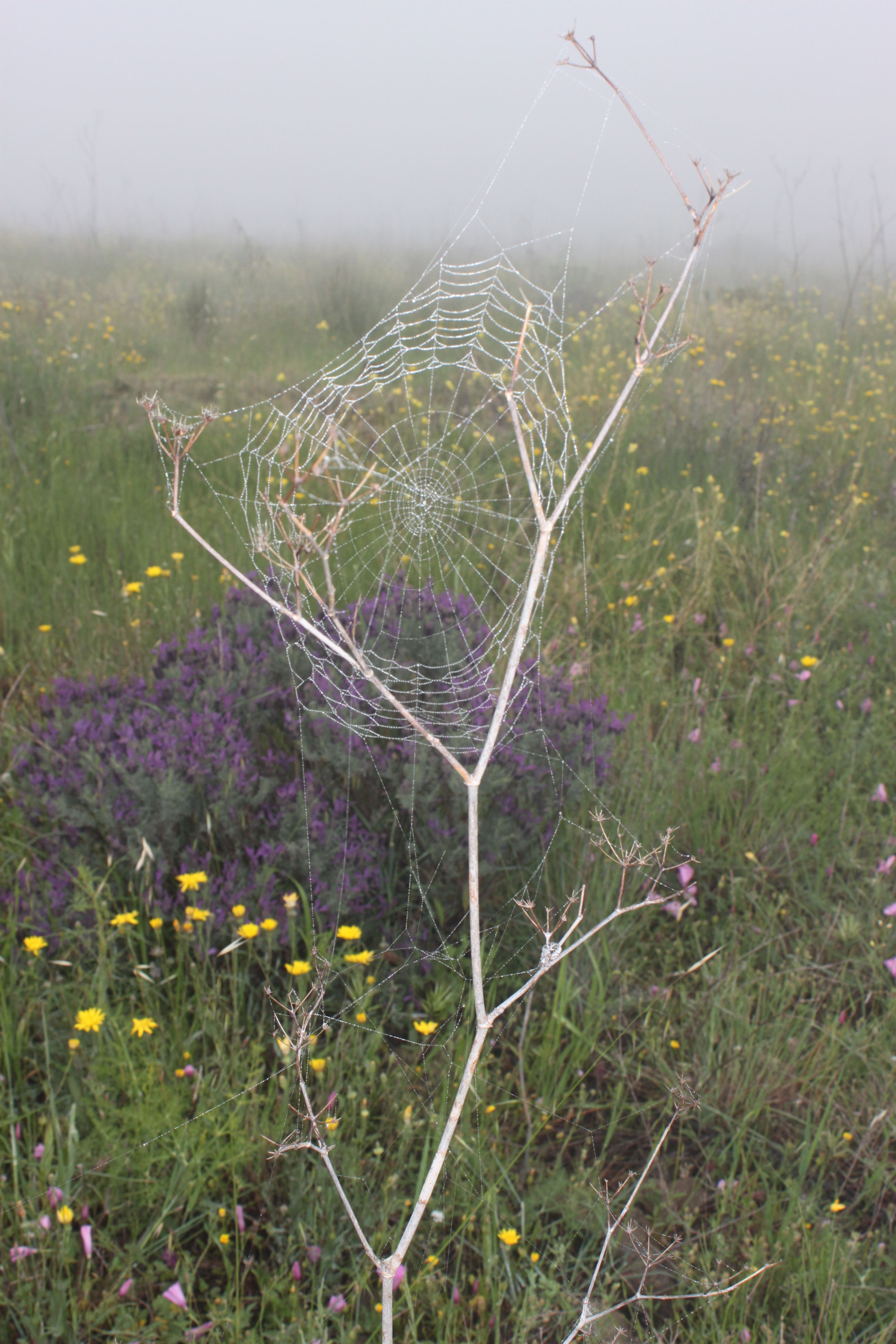
Forgive me; I paraphrase. Things started off with breakfast in the hotel restaurant, while chatting with a travel writer at the next table who commented on the unusually gloomy weather. After procuring provisions for the day (anchovy subs and a baguette from a local baker, Pim’s and water bottles from a local grocer), a taxi drove us out of town for half an hour, to the tiny hamlet of La Vall. The way this was supposed to work was, we’d get dropped off far from Collioure, and then hike back to town via trails over the mountains. It even started out that way; the taxi left us outside a shuttered church in a town so small, all 20 of its man-made structures fit in an area smaller than an oval quarter-mile track. A cold drizzle was falling as the taxi drove away; we pulled out our waterproofed map and direction-sheet and started hiking. The first hour or so was fine, if a bit cold and damp. Our spirits were high, and we took a few pictures.

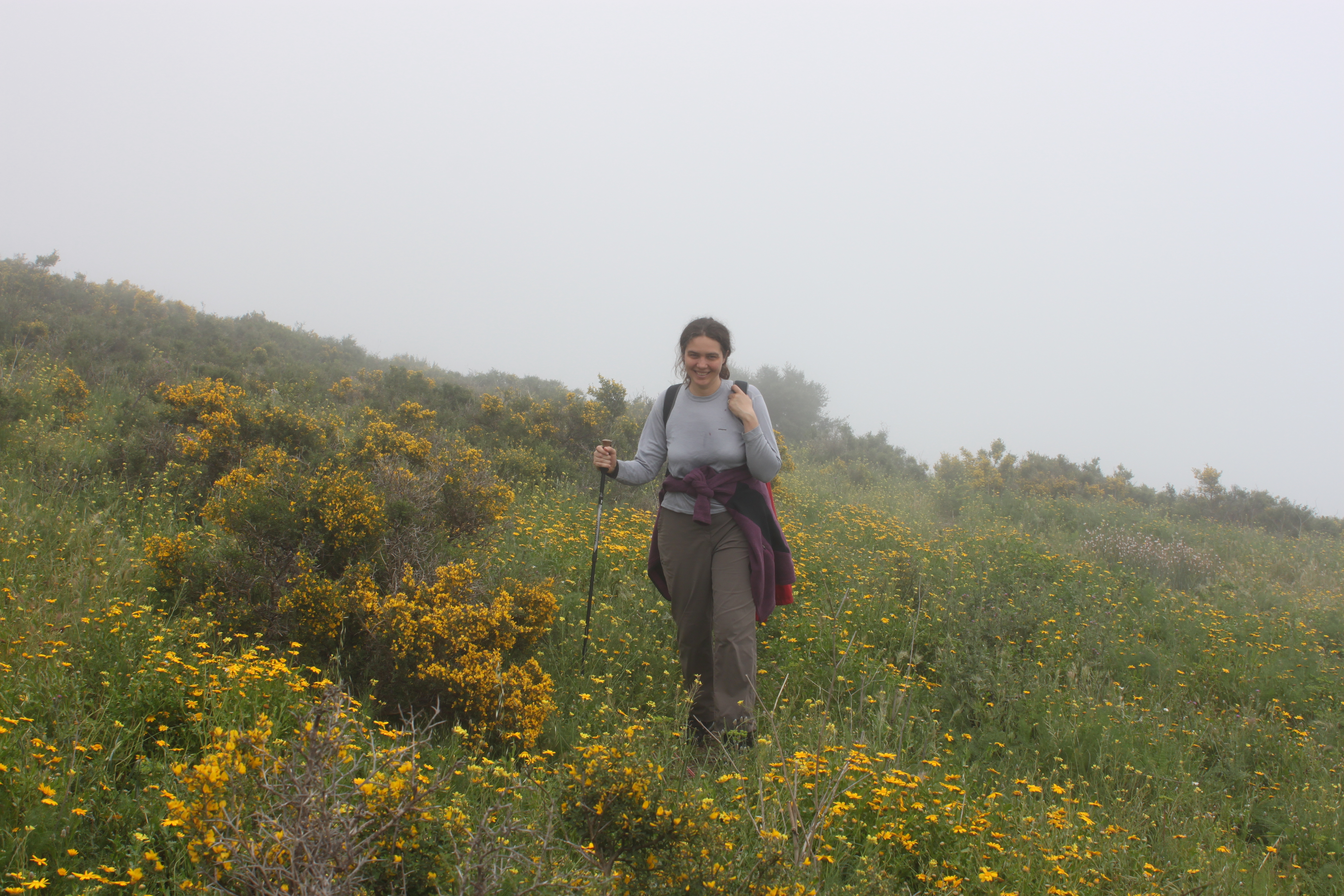
As we left the last signs of civilization behind and headed up the mountain, the trail split. We consulted our printed materials, and it seemed that either one of the two trail options would work, so we struck out up the tree-covered slope, following a series of orange blazes that matched one of the highlighted routes on our topographical map. In hindsight, the fact that the written directions didn’t specifically mention orange blazes should have been a clear sign of impending disaster, but… er… well, anyway, as we climbed higher and higher, the weather grew worse. After another hour or so, the rain was falling harder, the temperature had dropped and a chilling wind had kicked up, slicing through the trees and setting us shivering in our raincoats. (The actual temperature that day was just about 50 degrees, with wind-chills in the low 40’s.) Then the blazes ran out. The orange slashes on trees and rocks had at some point been joined by orange treble-clef symbols, which was cute, but probably meant we were following marks set by some music camp the previous year, and not anything meant for us. And somewhere up on the mountainside, both slashes and trebles ceased to appear; the trail ended at an orange raincoat wrapped around a tree-branch.
We spent a fruitless few minutes searching in every direction, but there was nothing – not even an unmarked trail for us to follow. Soaked and growing numb with the cold, we decided to abandon the day’s walk and head back to La Vall. As best we could we followed the orange blazes back down the mountain… and about halfway down, we lost them. So, there we were, a cold late morning rain pelting down, and the two of us lost on a forested foothill of the Pyrenees, miles from nowhere. The vacation had only one low-point, and this was it. I started seriously thinking about our emergency whistle, and whether anyone in La Vall could hear it from where we were. (Kate never panicked, of course, but I freaked out enough for both of us.)
We spent another half an hour searching the woods before we picked up the trail again, and half an hour after that we trudged into La Vall, hoping to find a phone by which we could call for a return taxi. The entire population of the town could probably fit into an elevator, and the one restaurant was closed for the season. No one was inside the church. There was no public phone, and not even a place to shelter from the rain so that we could break out the phone-function iPad. In the end we found a residence with a car in the driveway and knocked on the door. A hesitant woman answered, alongside her huge, growling dog. Kate speaks enough French that she was able to convey our need, and though the woman didn’t let us in her home, she did call us a taxi. We waited 20 minutes across the street from her house, squeezed under a tree while Kate ate her anchovy sub. (My fingers were too numb to get mine out of my pack.)
By one o’clock or so we were back at Les Templiers in Collioure, drying off and warming up and happy to be alive. I wolfed down my anchovy sub like I hadn’t eaten in days, and then we headed to a laundromat to dry our clothes and packs. As our soggy stuff tumbled, we reviewed the next day’s map, and holding the directions up to some extra scrutiny in order to prevent a recurrence of today’s failure.
Traveler pro tip: before you throw your stuff into a dryer, make sure your wife has really emptied out all her pockets.
Especially if they contain an old tube of lipstick.
Unless you’re going for the “hiker fresh from the slaughterhouse” look, of course.
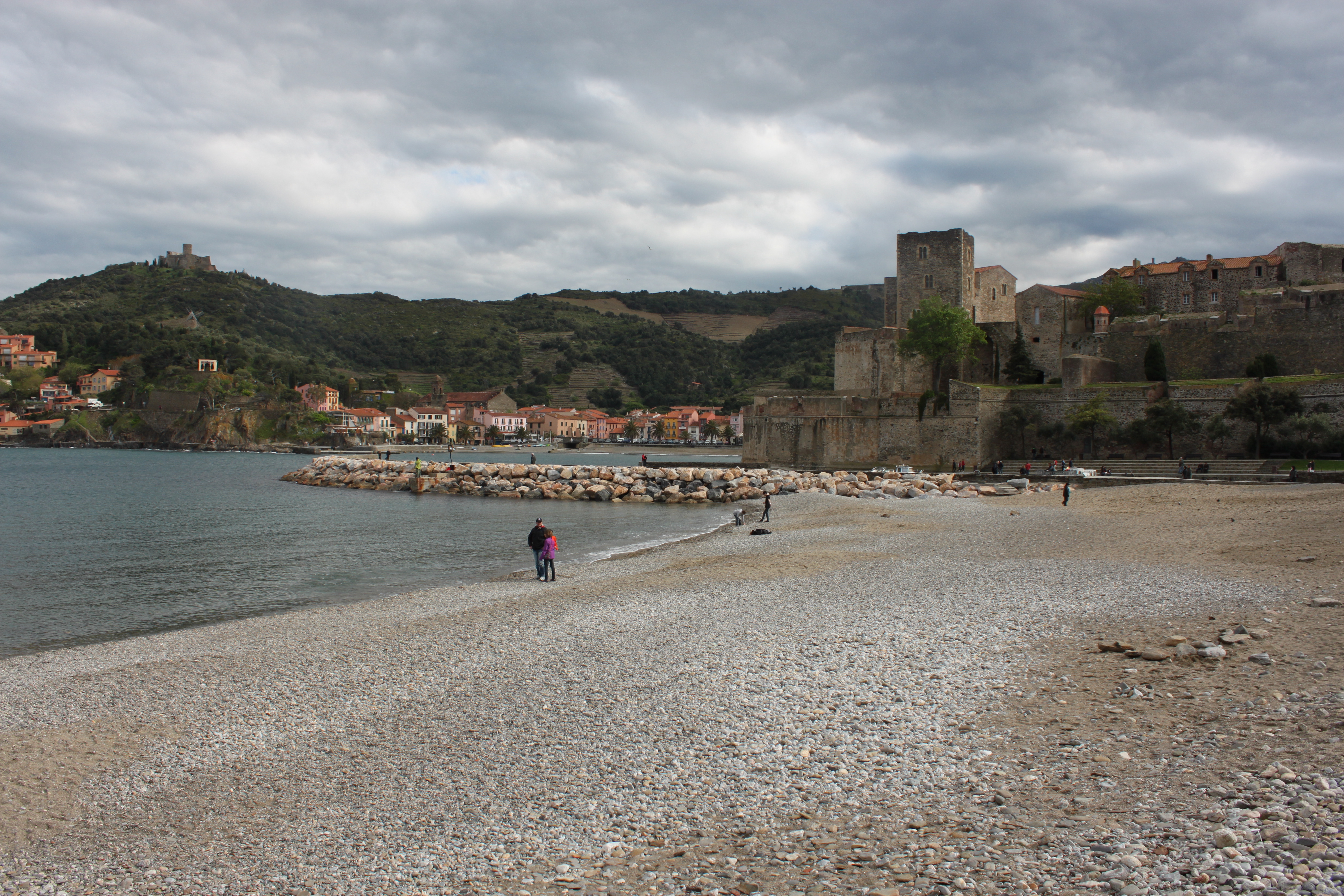
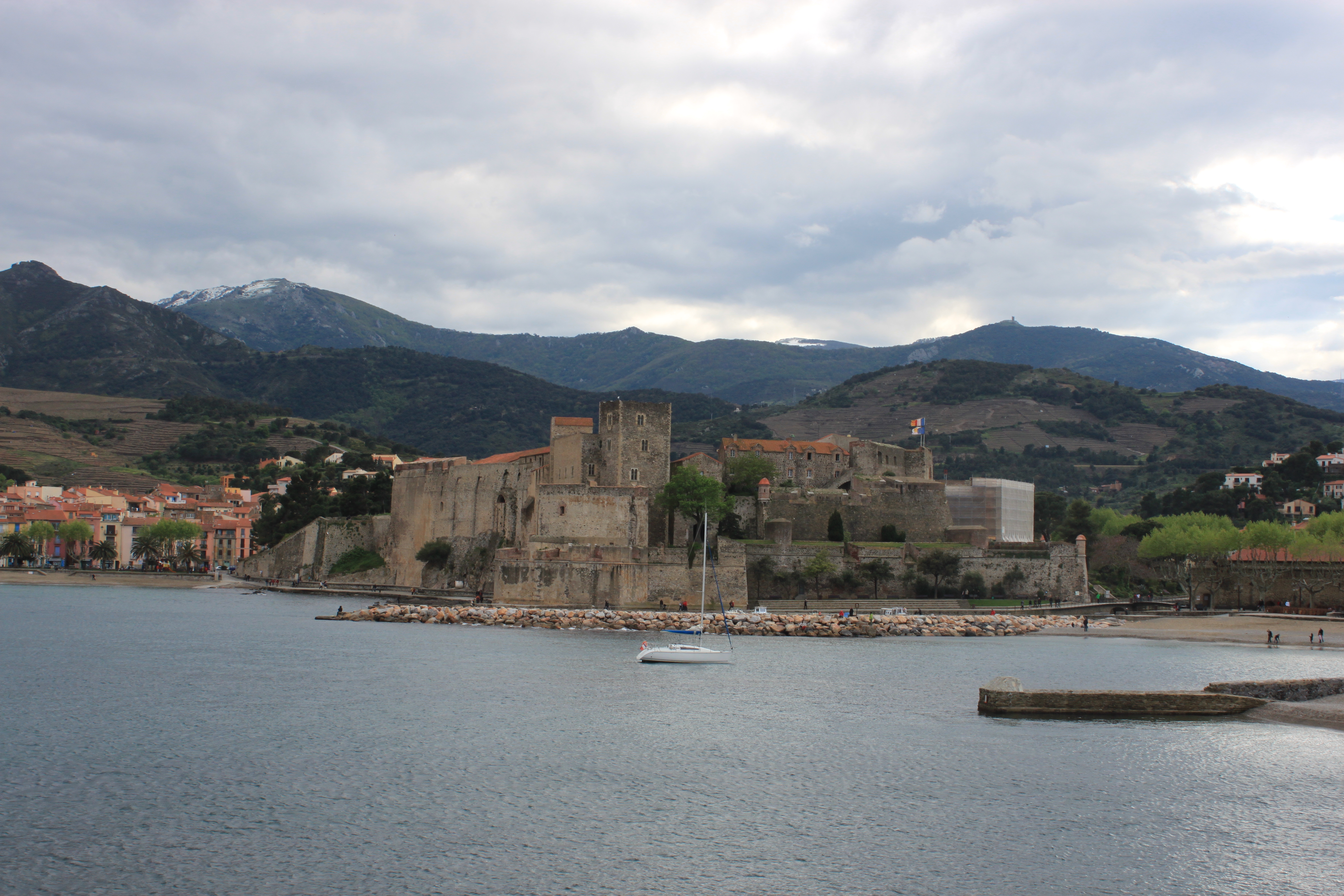
Anyway, the whole lost-on-a-mountainside fiasco turned out to be a lucky break in hindsight. The rain stopped by mid-day, it grew a bit warmer, and we spent a delightful afternoon exploring Collioure. We wandered around the exterior of its castle, explored its little streets, and I even did a bit of juggling with a local who was plying his circus trade on the beach. We also took many pictures, to make up for the ones we didn’t take while freezing in the wilderness.


A consultation with TripAdvisor on the iPad led us to l’Ambroisie for dinner, a tiny but wonderful restaurant whose cuisine was not equaled for the remainder of our vacation.
April 28 –Collioure -> Banyuls sur Mer
We sat next to our travel writer friend at breakfast again; she turned out to be the award-winning Solange Hando, still going strong at 69 years old. She told us a story about visiting the unheralded gravesite of Eugene Poubelle, a French pioneer in trash disposal and drainage, and the reason that trash bins in France are called “poubelles” to this day.
Once more we provisioned ourselves with delicious anchovy subs (Collioure is famous for its anchovies, which have been described as the best in the world), and prepared for a day of hiking. It was another cool day (temps in low 50’s, wind-chills in the low-mid 40’s), but the rain was light and sporadic, and the directions seemed straightforward.
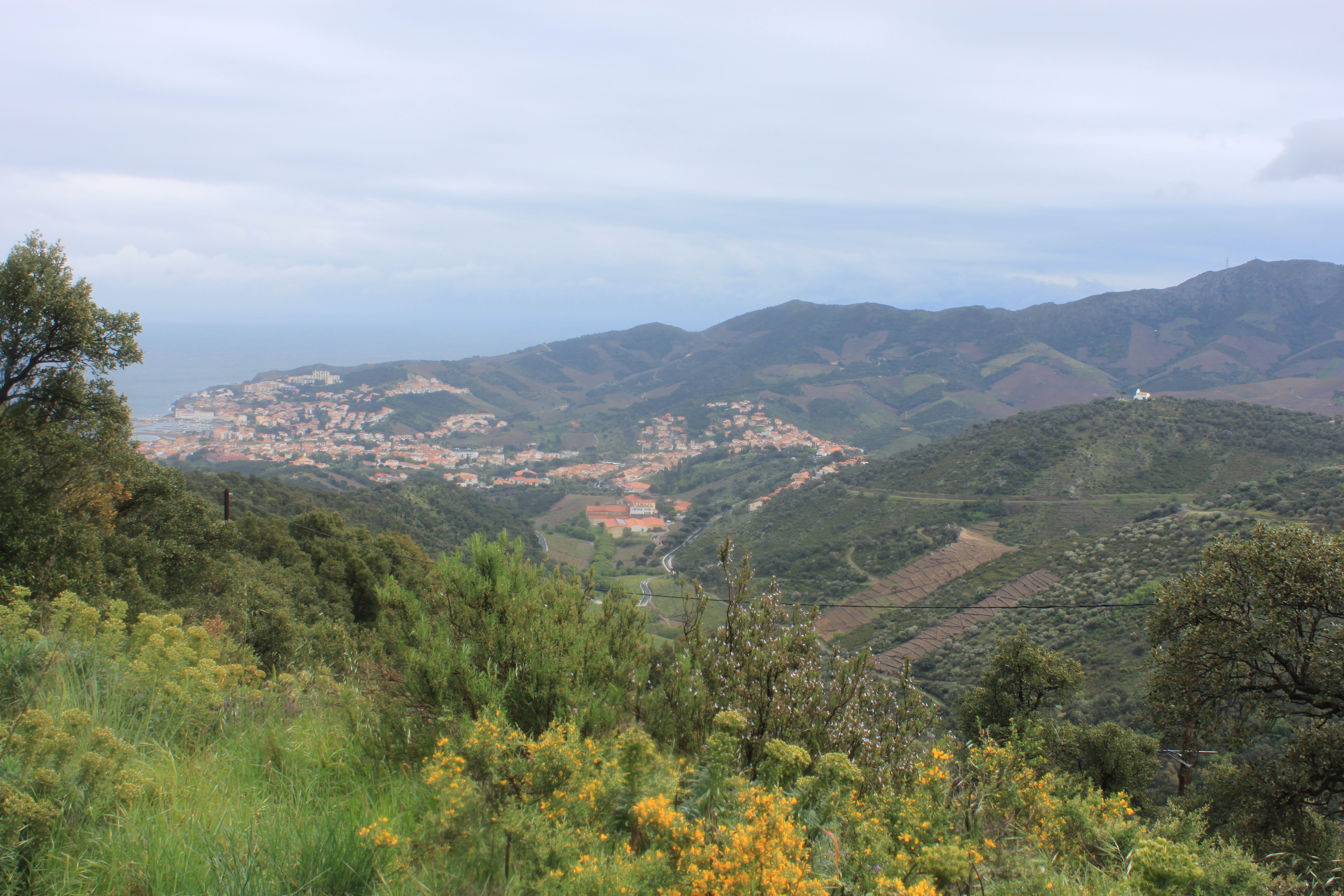
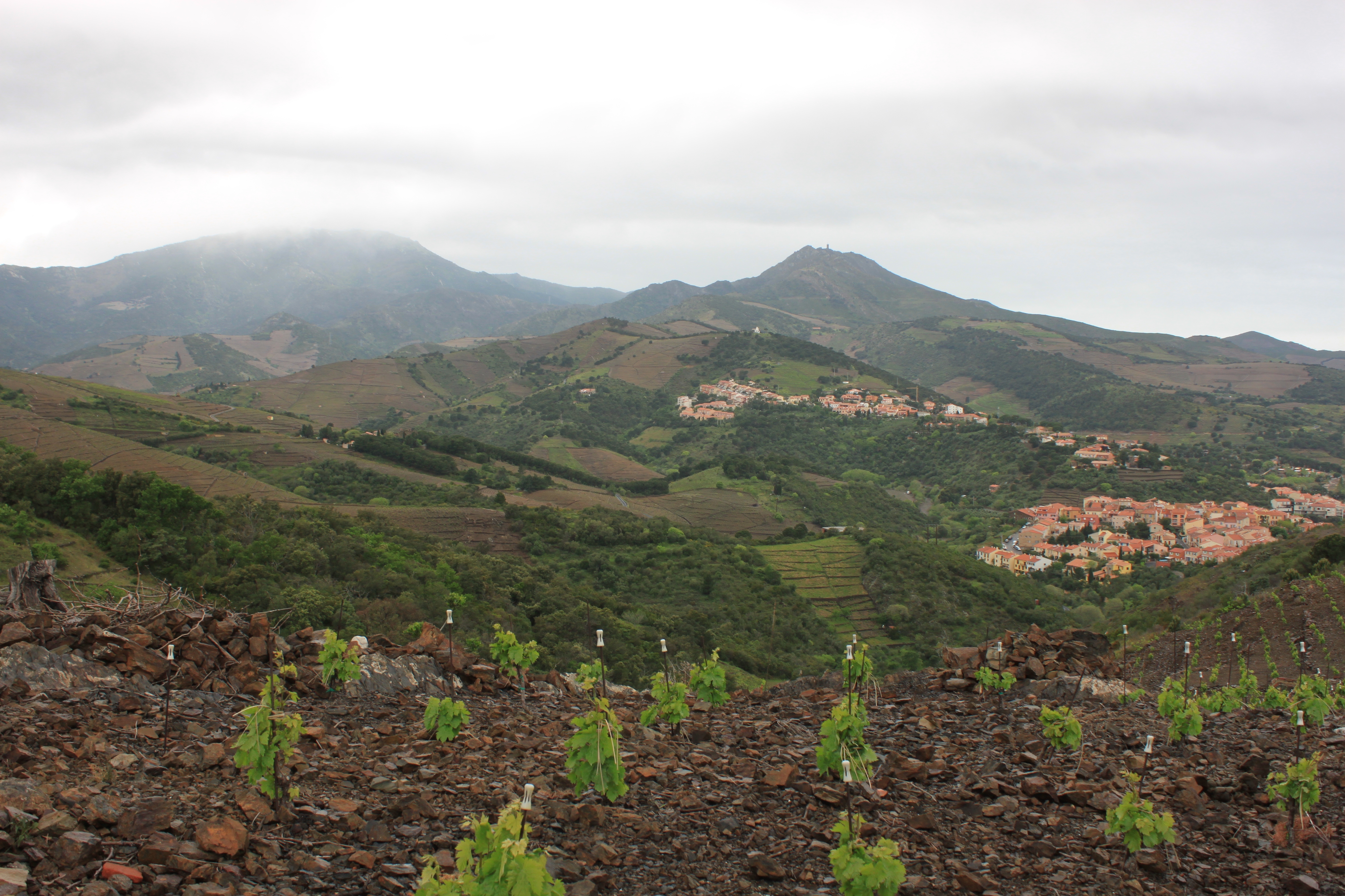
The day’s route, from Collioure to the city of Banyuls-sur-Mer (pop. 5000), would cover 9.3 miles and about 2700’ of elevation gain. Things started well, as we climbed up away from Collioure, stopping often to look back and admire the views.
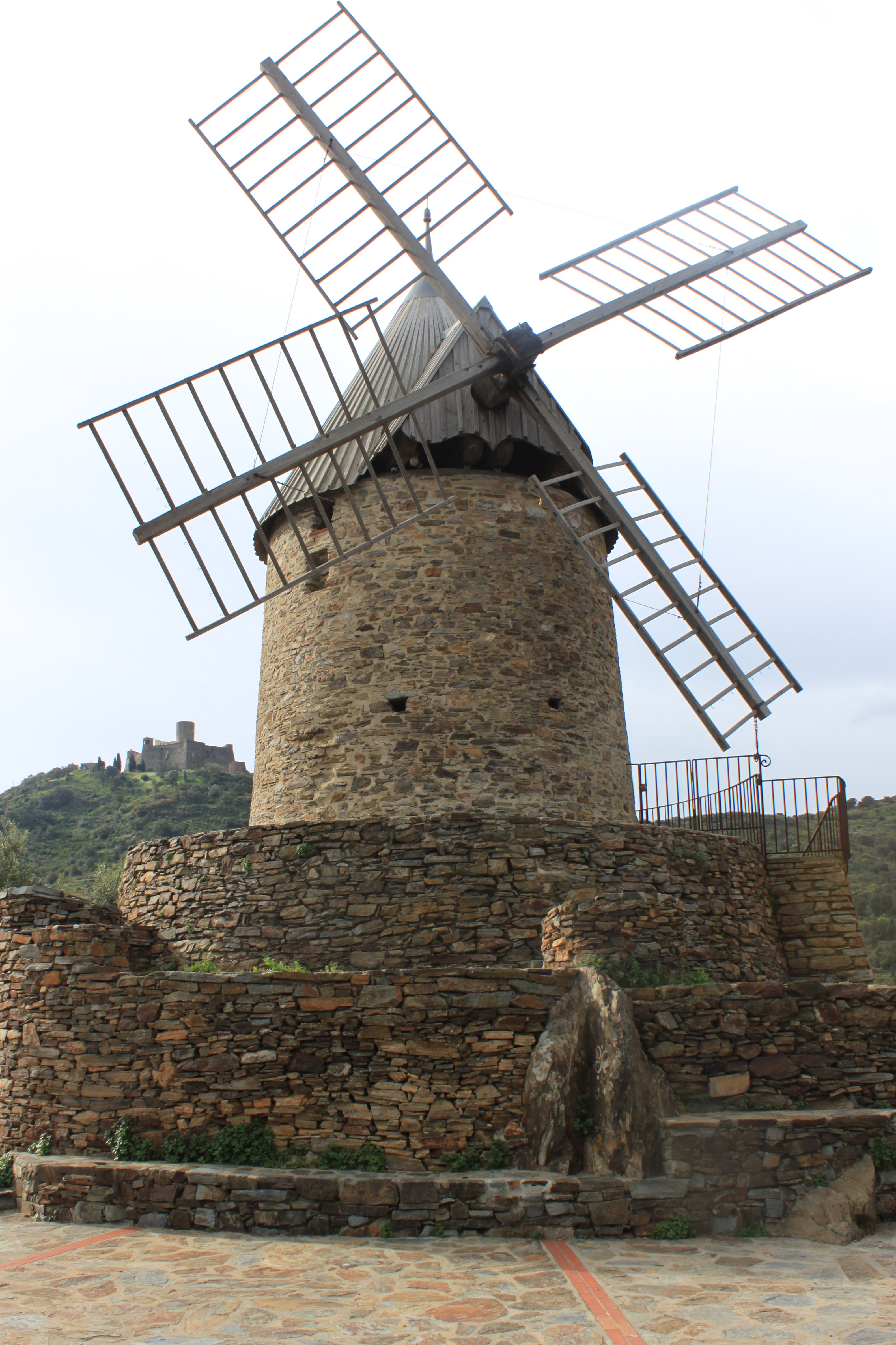
In short order we reached both the windmill and Fort Sant Elme, seen on the hillsides the previous day.
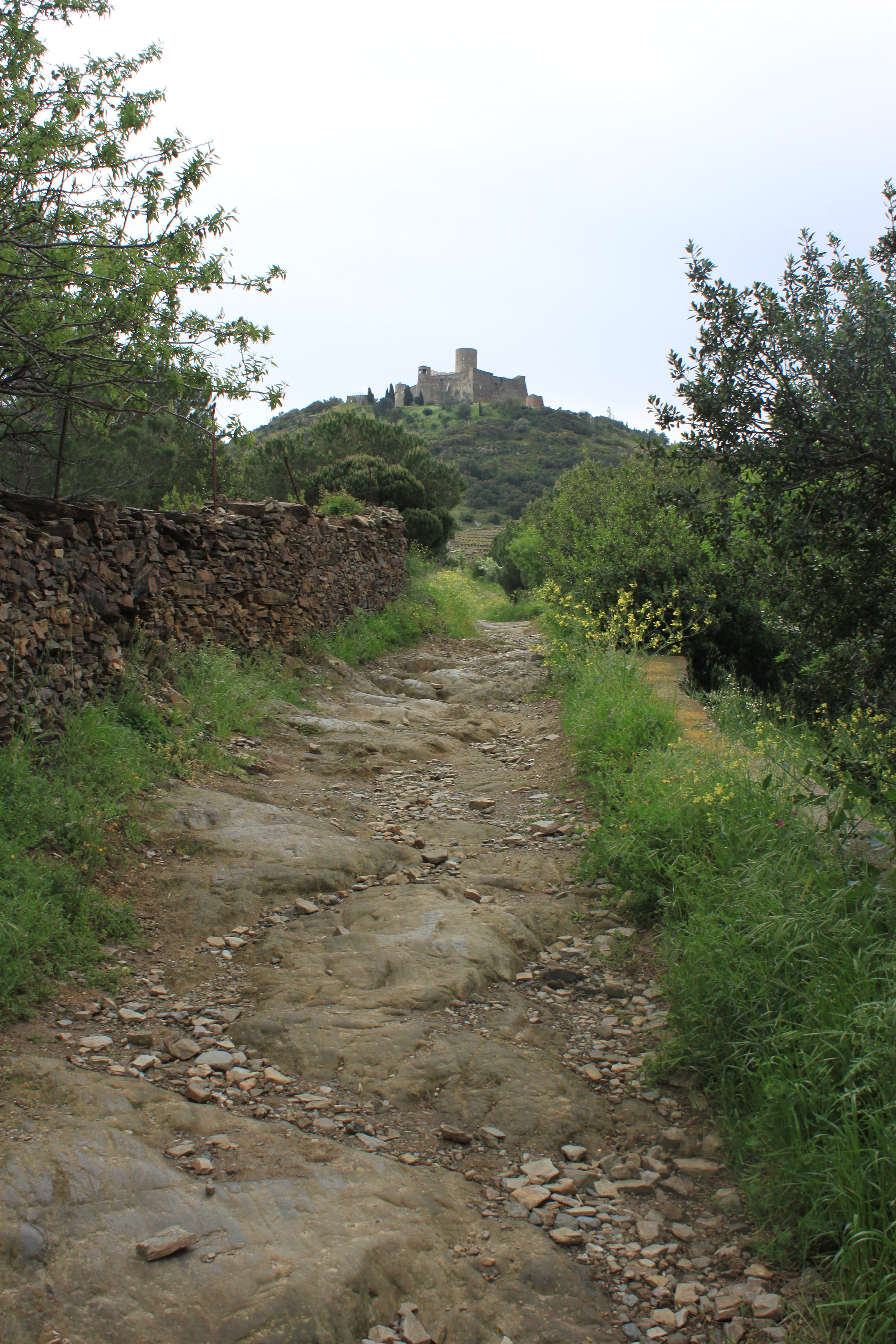

As Madeloc Tower (a 13th century watch tower) grew ever closer, our gain in elevation led to inevitable increased winds and lower temperatures. We stopped for lunch outside the walls of an old fort, then hunkered down for the final ascent.

In that part of the world, they have a name for the high north winds that blow across the mountains: Tramontane. Loosely translated, that means “winds so powerful only Americans are dumb enough to hike up mountains while it’s blowing.” Our directions even included an alternate route if Tramontane was blowing too cold and strong. But though the winds were indeed cold, and gusting upward of 50 mph, we were determined, after our ignominious failure of the previous day, to finish the route as intended. At times this meant leaning into the wind at such a steep pitch that had it abruptly stopped, we would have fallen over. We crouched low and scooted across exposed ridges, occasionally pausing and clinging to rocks when particularly powerful gusts kicked up, but at last we made it to the tower.

The views were not as stunning as the ones shown on the back of the box, but the feeling of accomplishment was real enough.
We didn’t stay long at Madeloc, and began our descent toward Banyuls-sur-Mer. As if the cold and the wind weren’t enough, a sideways-driven sleet started up, pelting us with stinging needles of almost-ice. We took shelter for a few minutes in a ruined fort, joining a dozen other walkers who were likewise waiting out the sleet. We gulped some water and ate some Pim’s, but as the sleet showed no sign of abating, we walked back out into it and kept going. The sleet kept up for about another twenty minutes before deciding to spare us, and I’m happy to say that as we marched down toward Banyuls, the sun even poked its nose through the clouds, making the final couple of hours extremely pleasant.

We followed the well-marked GR-10 footpath down into town, where we stopped for crepes in a local restaurant before walking the final 15 minutes to our hotel. Dinner at the hotel restaurant was lovely and featured a variety of local fromages.
A postscript: shower stalls in France feature a variety of mysterious extra nozzles and handles not typically found in the States. When I turned on the shower, water sprayed unexpectedly from a secondary shower-head that was angled upward such that in about five seconds, I had hosed down every wall in the bathroom. Silly American!
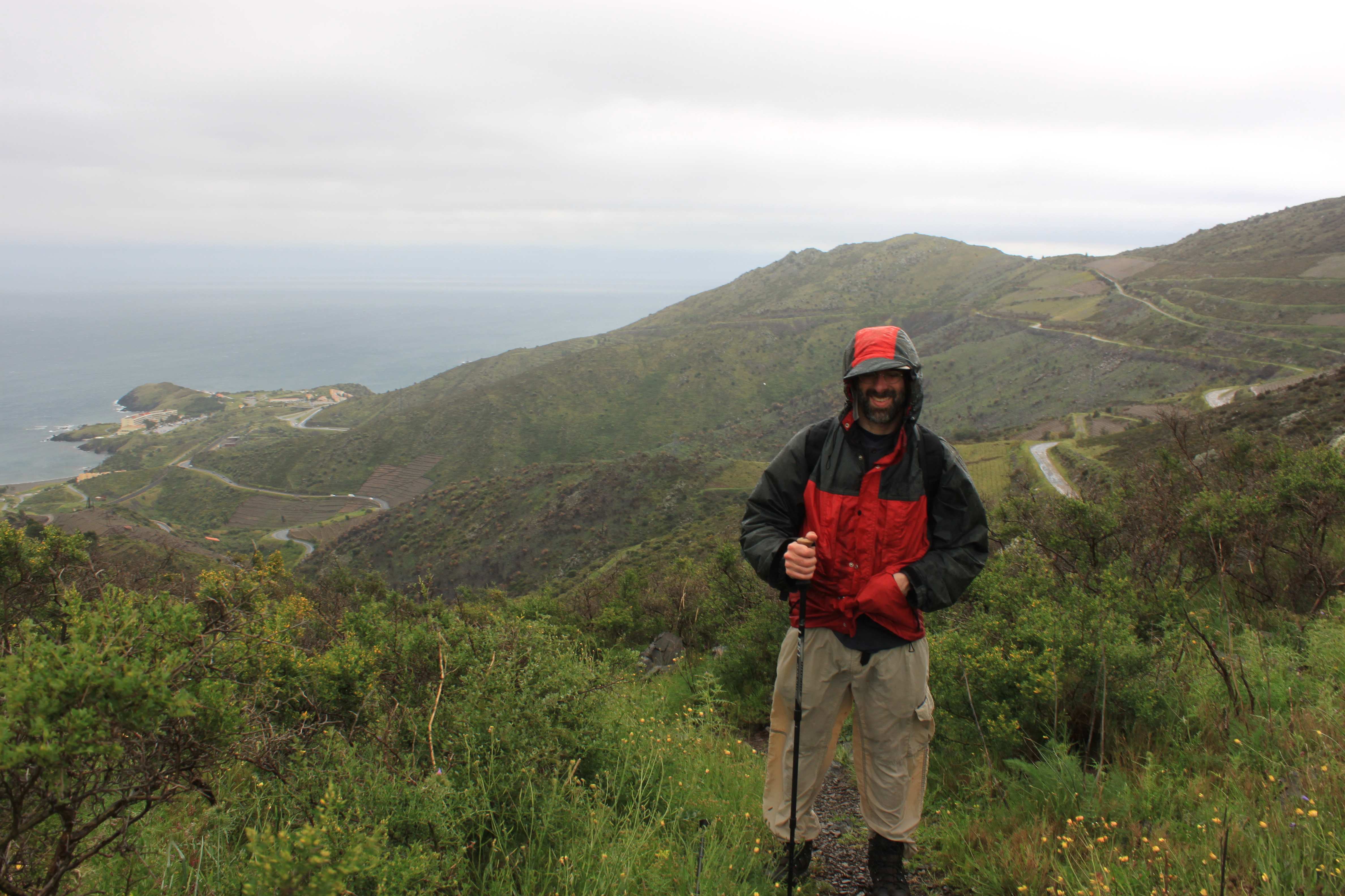
April 29 – Banyuls sur Mer-> Portbou, Spain
“This could be Scotland, if it weren’t for the cactus and palm trees.”
That was Kate’s comment as we walked through town to start another day of hiking. The sky was overcast, and the Mediterranean a steely Atlantic gray. The weather forecast was extremely grim: rain in the morning, rain in the afternoon, more low temperatures, and a strong wind throughout. But for the morning, at least, the rain held off and the air wasn’t too cold. Also this was a shorter and easier day than yesterday – 8 miles of walking, with about 2000’ of elevation gain.
We stopped for provisions at a small convenience store. The poor weather was so unusual, it was the front page story of the local newspaper on the store rack. Yay, us. The woman behind the counter was full of sympathy. “Weather is so sad,” she said. “Like English weather.”

As if to drive the point home, our directions indicated that we should “…walk along [the] road, with a dry riverbed on the left…” but the riverbed was anything but dry. Dozens of swallows took advantage of this unusual state of affairs, darting and swooping and collecting the insects the water had brought.
The first part of the walk was a steep, zig-zagging ascent through the outer streets of Banyuls-sur-Mer, before the trail rose up and away from the town. The rain held off until we were up on an ascending ridge, and even when it fell, it wasn’t a torrential downpour. After a slightly-harrowing ridge walk with a cliff on one side, and an upward climb following a dry stone wall, we reached the final scramble to a local maximum. The directions were phrased thusly: “About 6 mins after the wall, you are confronted with a rock band in front of you, a 5 metre strata of schist. Don’t bother looking for a way around it, the yellow waymark on your left means go straight up!” But it wasn’t any more difficult than any number of rocky scrambles we’ve made in New Hampshire, and soon we were having a snack next to a high tension power-cable pylon perched on the hilltop.
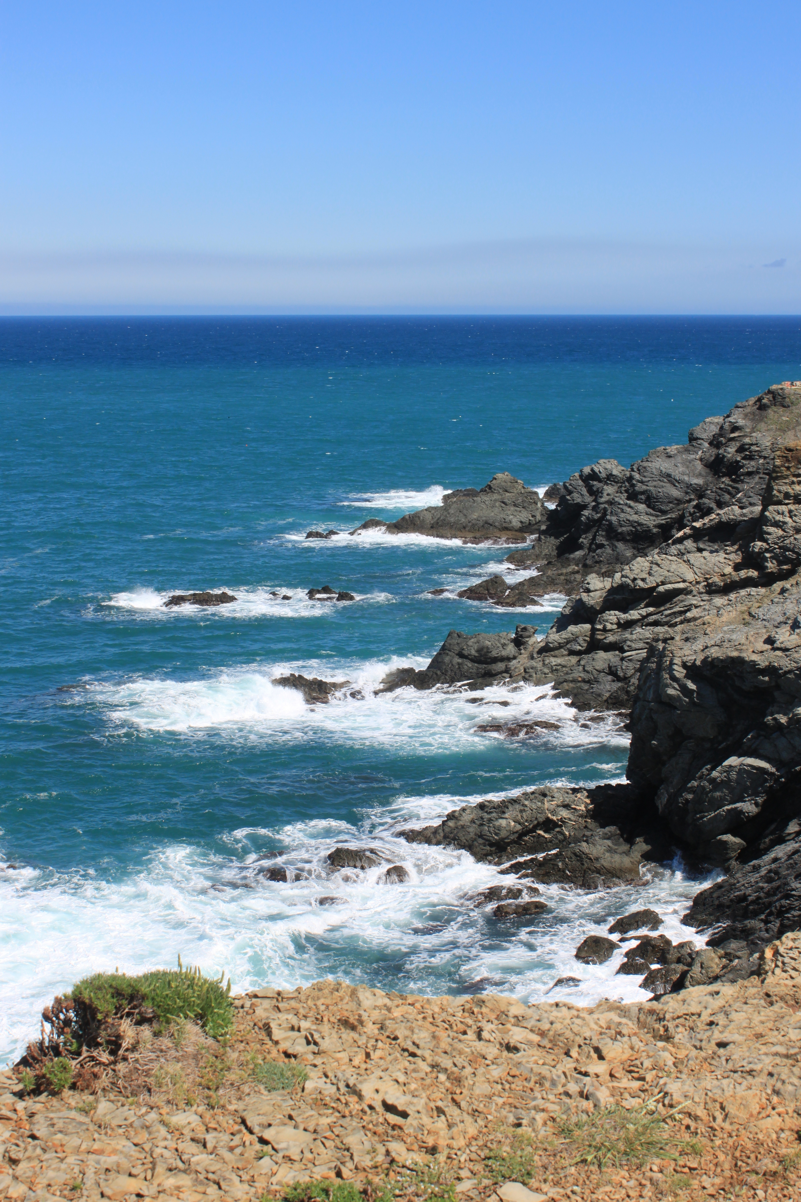
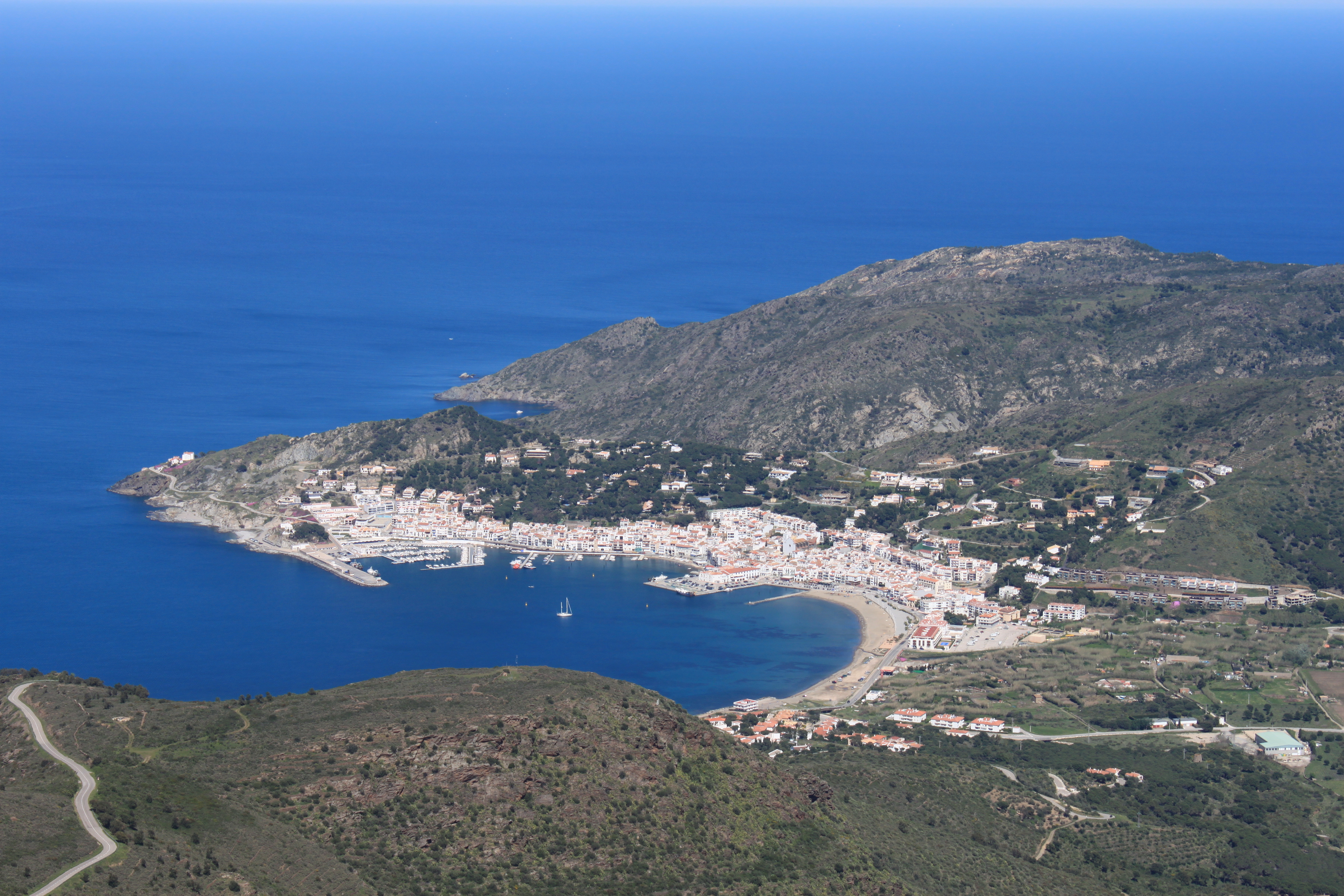
The rain was on-again, off-again (though mostly on-again) as we traversed a long section of high trail cut into the mountains that separate Banyuls-sur-Mer from Cerbere, and Cerbere from Portbou. Portbou (pop c. 1300) was the Spanish town where the day’s hike would end. There were lovely views throughout, and while the cold, wind and rain prevented us from appreciating them properly, Kate still stopped to take pictures.


The rain let up slightly as we crested another hill and reached the ridge separating from France from Spain. We stopped there for lunch, and to take the inevitable pictures where we’re standing in two countries at the same time, before starting the long descent to Portbou.

Given the portentous weather forecast heading into the day’s travel, we were counting ourselves extremely fortunate that for hours now, the rain had been sporadic and mostly light. It turned out the Weather Gods were just toying with us. While still on the high and shelterless trail, the heavens opened wide and sheets of rain fell upon us. Or, more accurately, sheets of rain were driven sideways into us by the 30+ mph winds blowing across the ridge. It was like being sprayed by a host of angry firemen just off stage, and in less than a minute we went from tolerably damp to just-climbed-out-of-the-pool drenched. Our boots filled with water in about 20 seconds, so every step thereafter was made as if our feet were simply encased in water balloons. The downpour lasted about 20 minutes, though for the final 19 of those we weren’t really getting much wetter, having so quickly reached maximum saturation.
Perhaps realizing their diminishing returns the Weather Gods turned off their hoses, and the final hours of downward trek into Portbou were actually quite pleasant, marred only by the squishing sounds our feet made with every step. The hillsides above town were covered with cactus and lavender, and we wended our way through on a tiny narrow path, at last reaching town and our hotel.

We managed another FaceTime session with the kids that evening, and they seemed both happy and uninjured. Actually, they seemed like circus clowns, since the moment they realized they could see themselves in the little FaceTime window, they started hamming it up, making one ridiculous face after another, giving each other bunny ears, and constantly shoving one another out of the frame. Good luck, Grands!
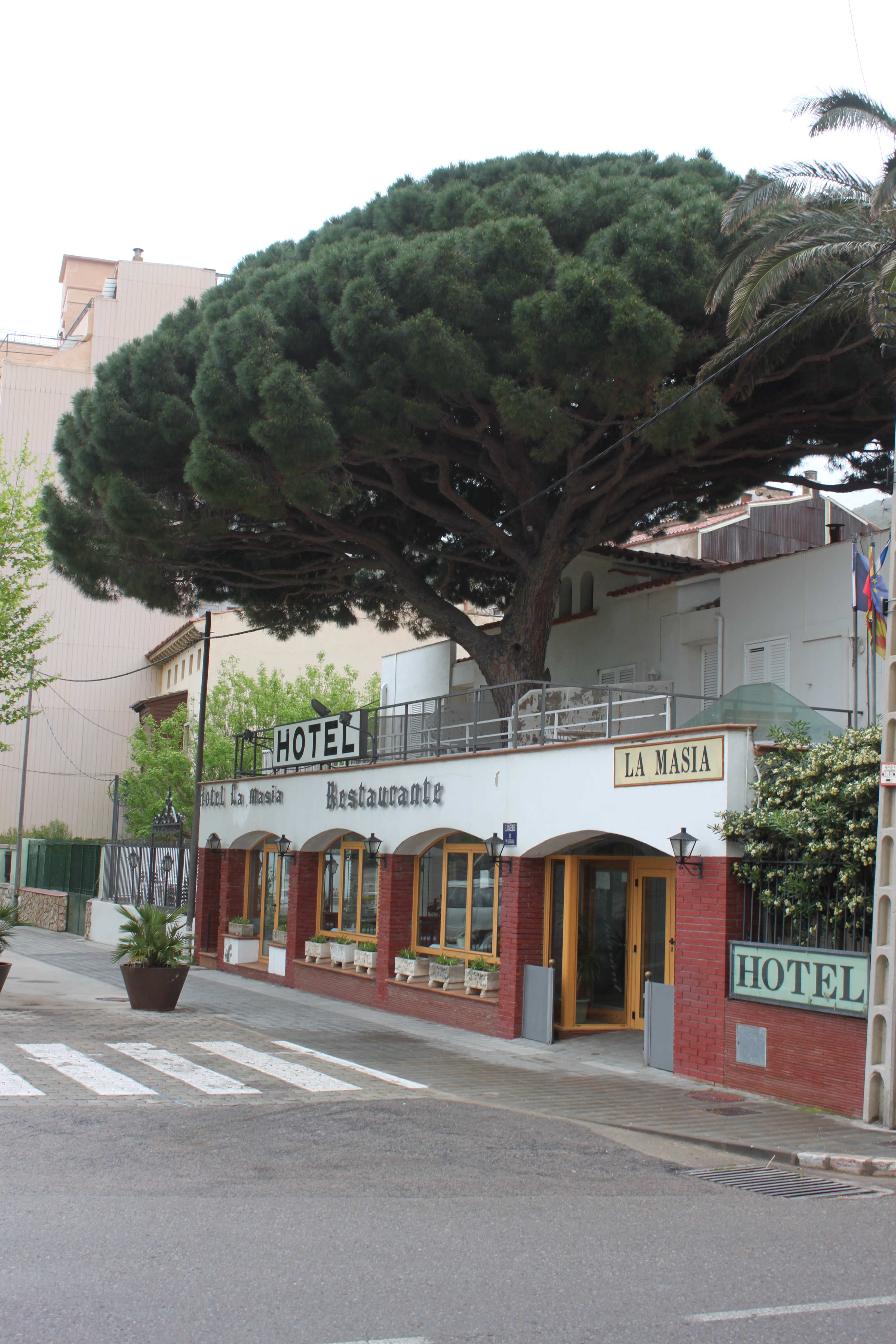
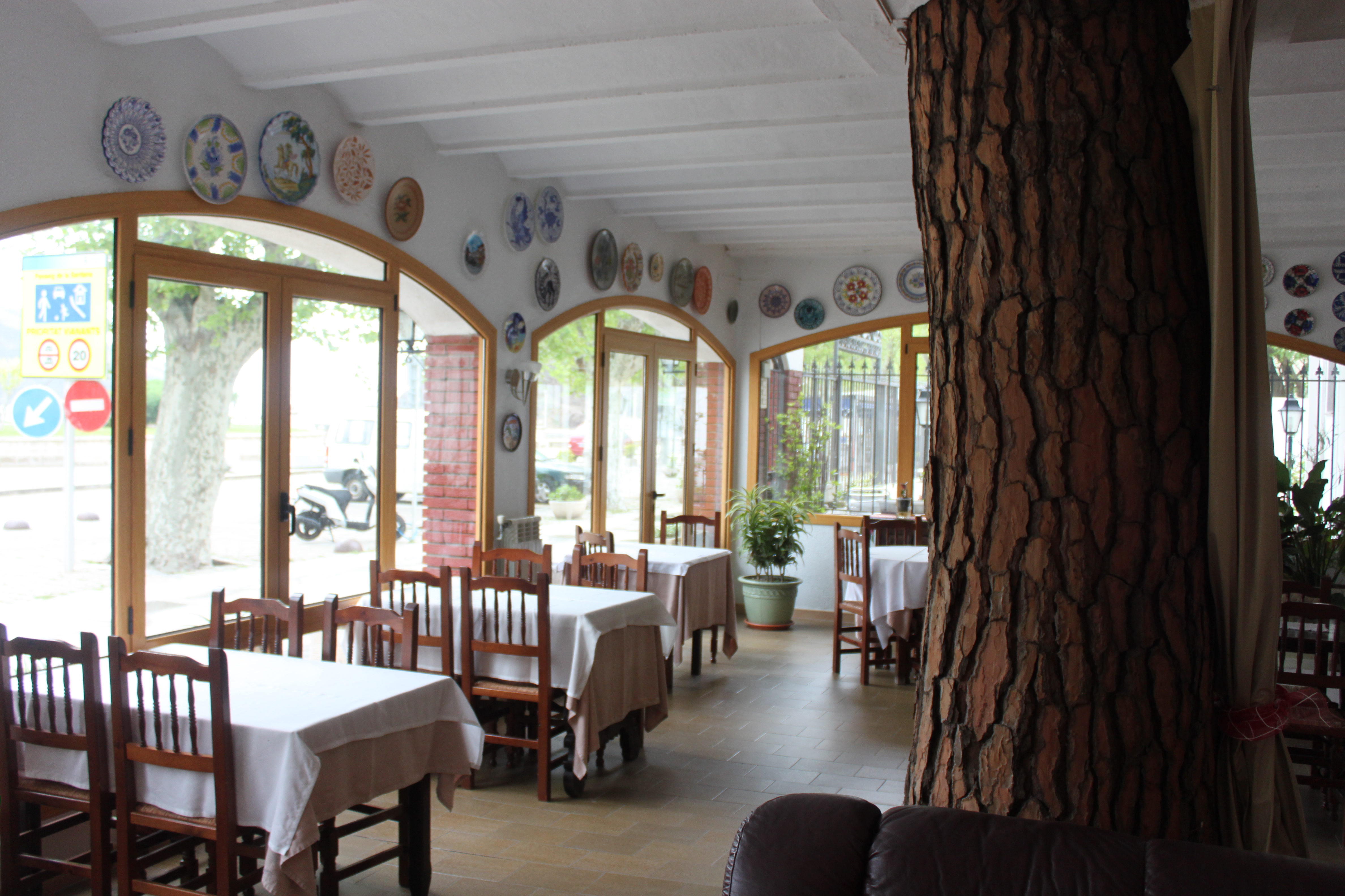
April 30 – Portbou -> Llanca
Portbou was a sleepy little town, and there wasn’t much of interest save the tree that was growing inside our hotel.
We walked around a bit before setting out for the day’s hike, mostly in the vain hope that the bakery down the street would open up. It didn’t but we weren’t too worried about provisions, since we’d be passing through an intermediate town half-way through the day, and there was purported to be an excellent restaurant on a beach we’d be reaching around lunchtime.
The weather was still Scottish; a bit warmer, perhaps, than the previous days, but the clouds were draped low over the hills, and a damp mist filled the air. We climbed up a steep hill out of the town, rising into the clouds, and soon Portbou had vanished into the fog. Today’s leg was 8 miles, with 1650’ of elevation gain.

An hour into the day’s march we reached a high point. Quoth our direction sheet: “You now walk on a beautiful path for the next 25 mins or so… You have wonderful views across the bays, but probably as the sun is in your face, it will be hazy.”
The what now?
The trail was beautiful as advertised, and the Mediterranean below us certainly sounded lovely, but we couldn’t see anything more than a hundred feet away seeing as we were walking inside a cloud bank.


After a time the trail veered downward and below the cloud layer, and we descended into the small town of Colera (pop. 600).

We stopped for some ice cream, but Kate convinced me that we didn’t need to eat anything more, since we weren’t far from Garbet Beach where the restaurant awaited.
The directions indicated that we should cross a bridge over the bay – the only bridge, apparently – but it was closed for construction. Hm. We sat and consulted the topo map on our iPad, and found an alternate route that followed a trench-road with a steep rough-cut stone stairway rising up where the bridge would have ended.


The original pathway cut over to a mainland track that brought hikers down to Garbet Beach, but a rich landowner had built a house across it and prohibited hikers from trespassing. Instead, we had to skirt around the cliff face, as the new path involved wading through the Mediterranean. Had we arrived at low tide we wouldn’t have gotten our toes wet, but we didn’t, and there was probably some extra surge from all the recent wind and rain, so in places we were up to our knees as the waves came crashing to the cliff wall.

(Aside: having been warned of this possibility, we had stowed sandals in our day packs. Kate took her boots and tied them to the outside of her pack. I had the clever idea of tying my bootlaces together and stringing them around my neck, but it turns out that any plan that involves boots you’ve been hiking in for days being suspended inches below your nostrils, is a very, very bad plan.)
It took us only about 15 minutes to wade and rock-hop around the cliffs, after which it was only a short walk across the beach to the restaurant.
Which was closed.
Reports that I gave Kate a hard time about this are not exaggerated in the slightest. Lunch consisted of two apples we had been lugging around since Collioure, and a half-empty container of Pim’s.
As we prepared for the final leg of the day’s walk, a very strange thing happened. A weird and frightening yellow orb appeared overhead, and both sea and sky turned a very strange blue-ish color. It was very confusing at first, but after some discussion we figured out what was going on. The sun was shining! We took many pictures of this odd new phenomenon.

Despite our hunger, our spirits stayed high as the day grew brighter and bluer, affording us (finally) the views we had been hoping to see since the start of the walk.

Finally we strolled into the large town of Llanca (pop. 5000), where we stopped at a beach-side tapas restaurant that had the decency to be open. We sat, delighted, watching kids frolic on the beach while we ate anchovies and calamari and Kate consumed a large glass of sangria.
At last it was time to walk the final leg to the hotel. “But not just yet,” said Kate, glancing at her sangria glass. “I don’t think I should stand up right now.”
May 1 – Llanca -> Port de la Selva
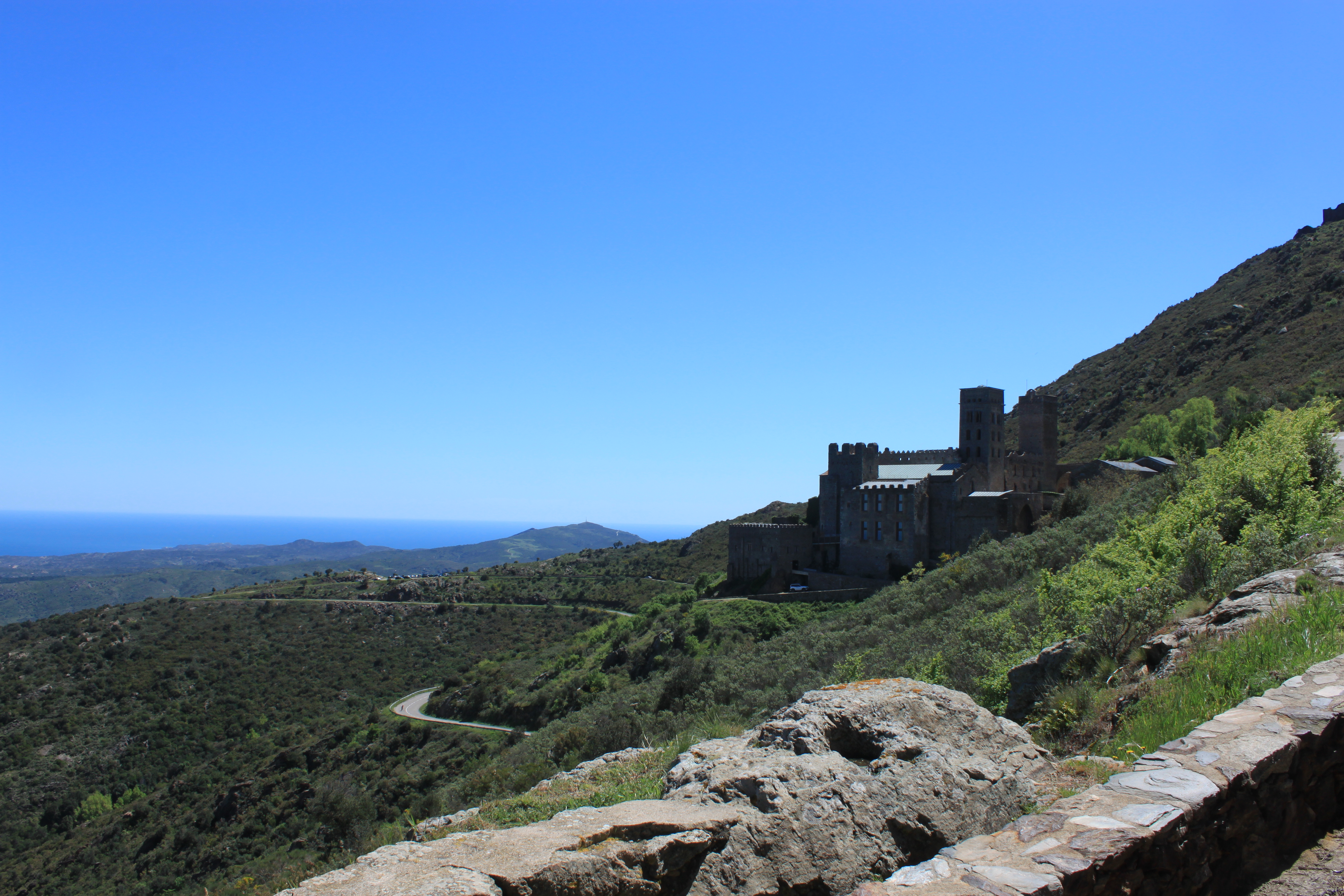
This was the final day of our walk – an expected 7.4 miles, with 2750’ of elevation gain, between Llanca and Port de la Selva, with a midway stop at the monastery of Sant Pere de Rodes.
We bought lunch in town in order to guarantee that the monastery’s restaurant would be open, and packed our rain jackets and pack liners to guarantee good weather. (Both ploys worked, though it meant that Kate hiked the entire day with an uneaten baguette poking out the top of her pack.)
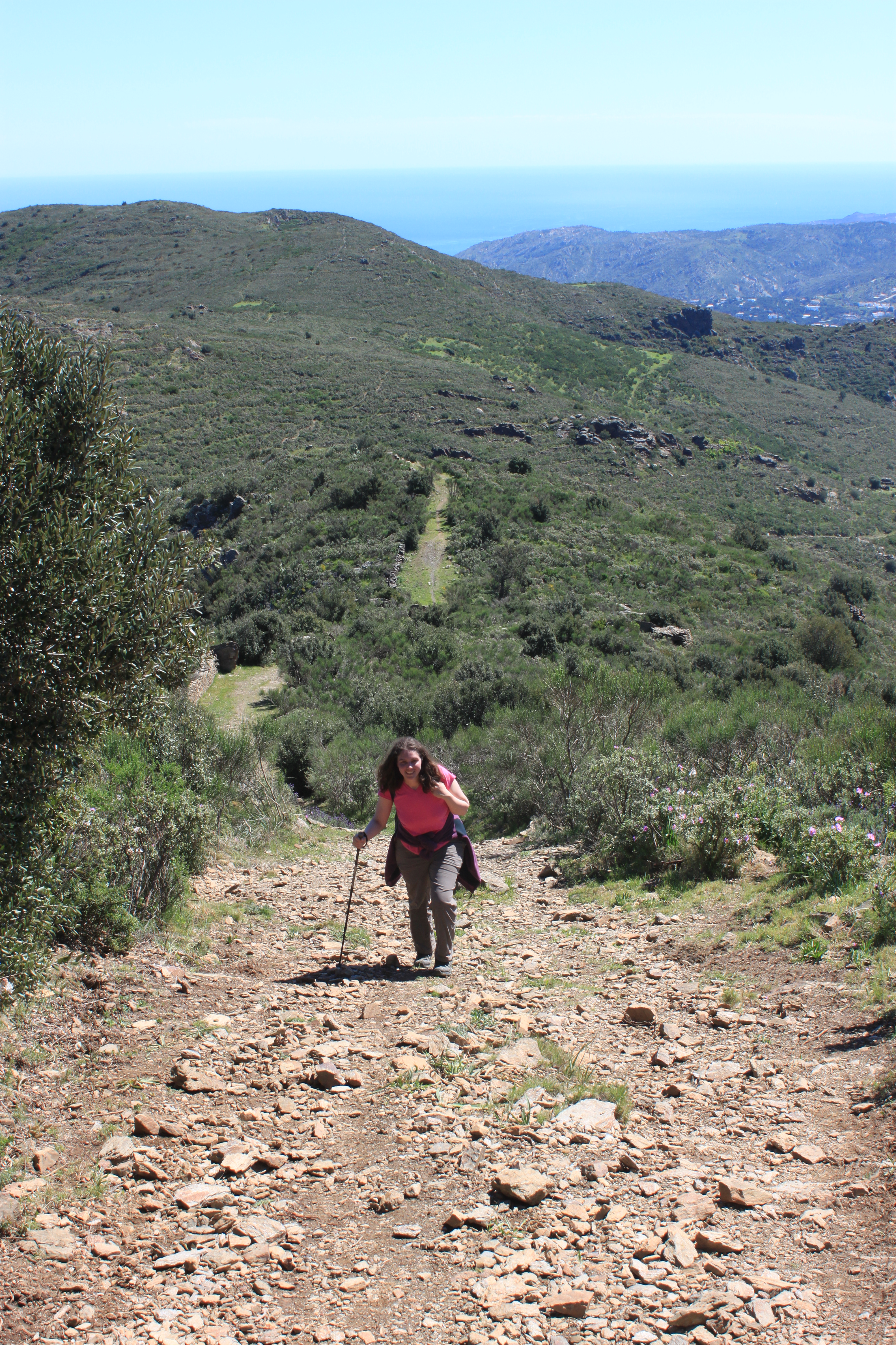
For the fourth straight day we climbed steeply up from our starting town into the low Pyrenees. To our confusion and delight, the sun shone from a warm blue sky for the entire day, and so we were able to soak in the experience in a purely metaphorical manner.


The trail wound up and over the hills, through ancient stone walls, until we started getting peeks at Sant Pere de Rodes.
 First glimpse of Sant Pere de Rodes
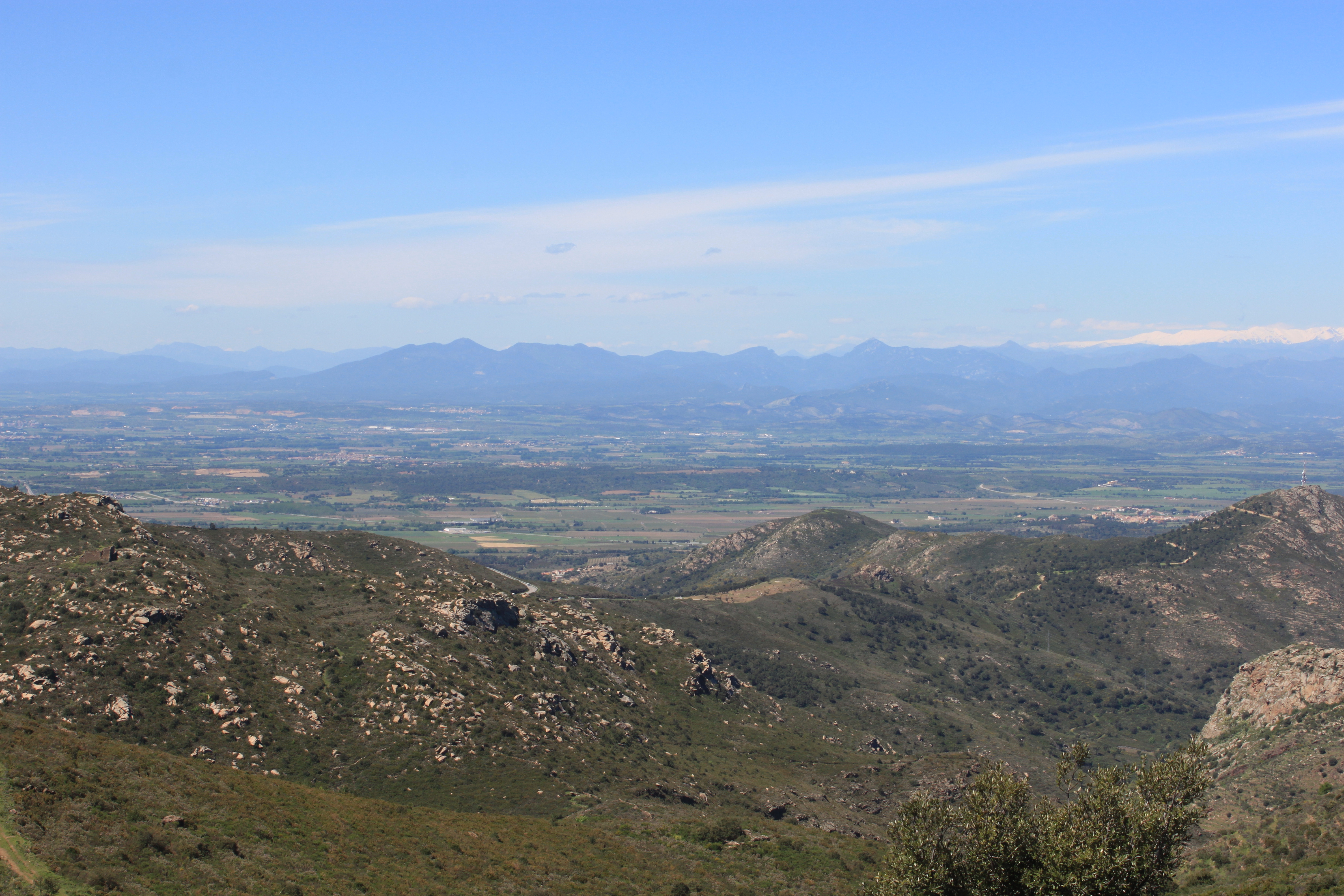
Finally we reached a gap between peaks call the Col de Perer, from which the expansive views over endless miles of Spanish farmland were utterly breathtaking.
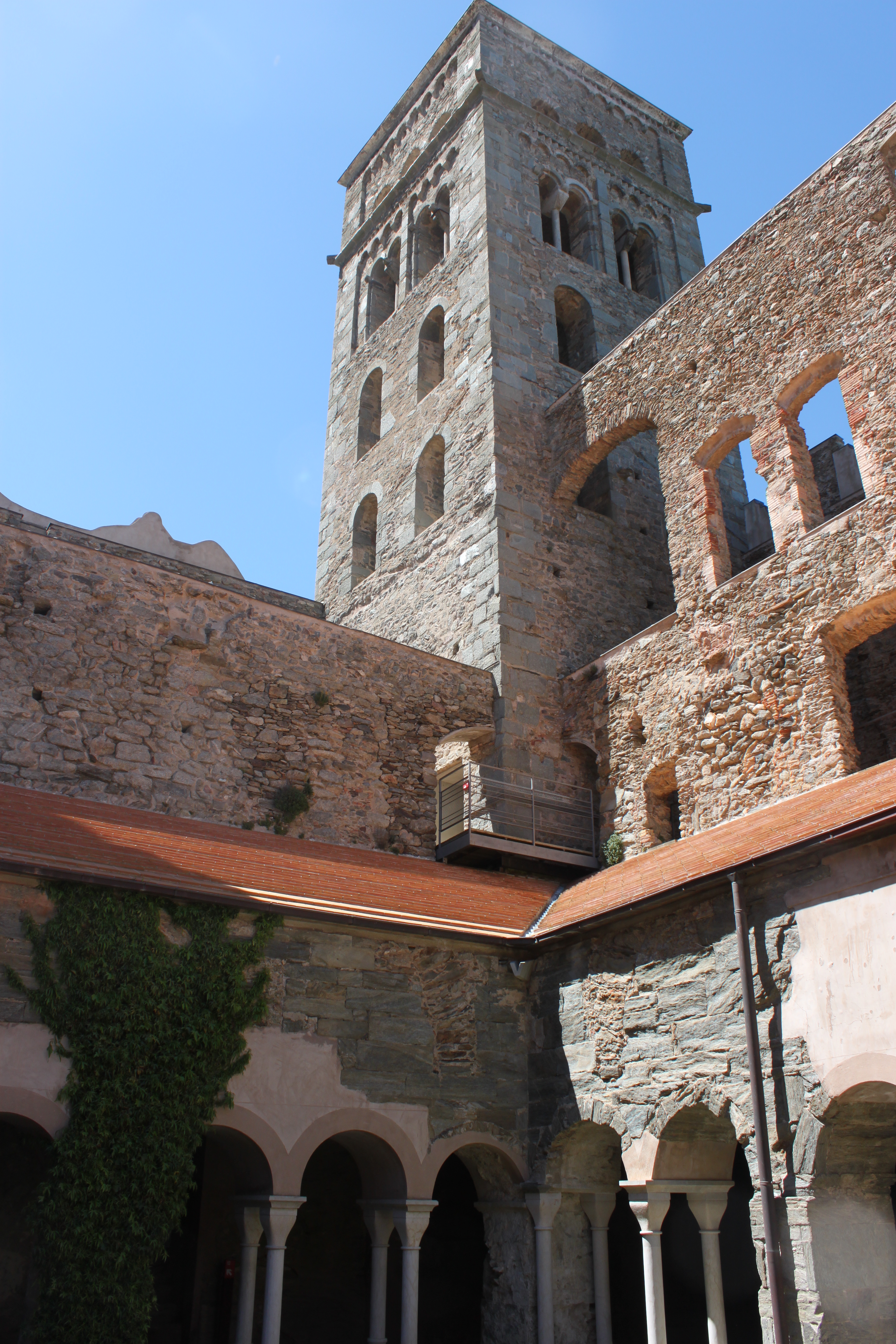
From there, a wide dirt track led slowly upward to the monastery, a Benedictine abbey constructed mostly in the 10th through 12th centuries. There we had lunch and spent an hour exploring the monastery’s interior, before hiking the 500’ up to the ruins of a small castle perched on the mountain peak above.
 Final approach to Sant Pere de Rodes
 Looking back upon Llanca from the monastery.
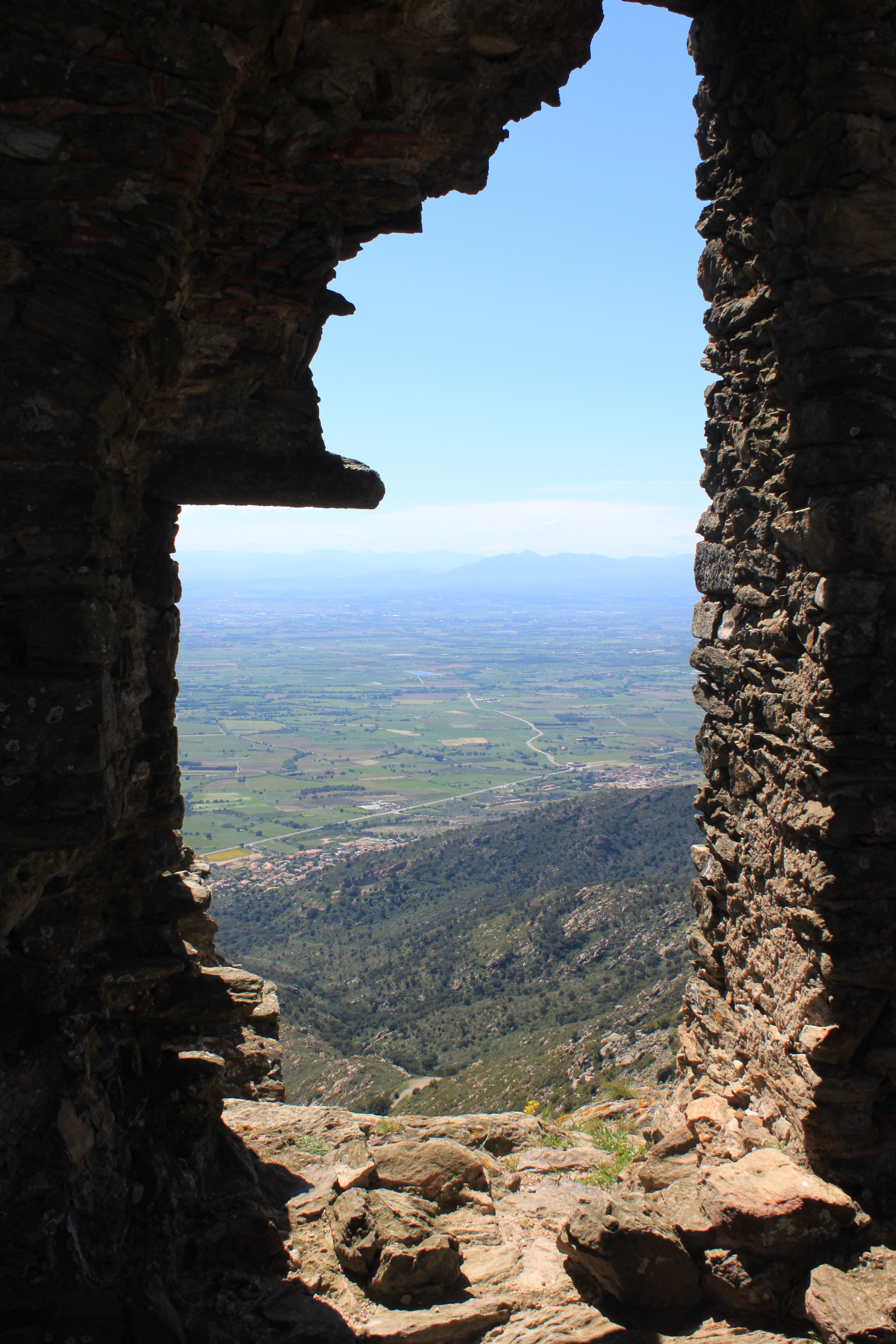

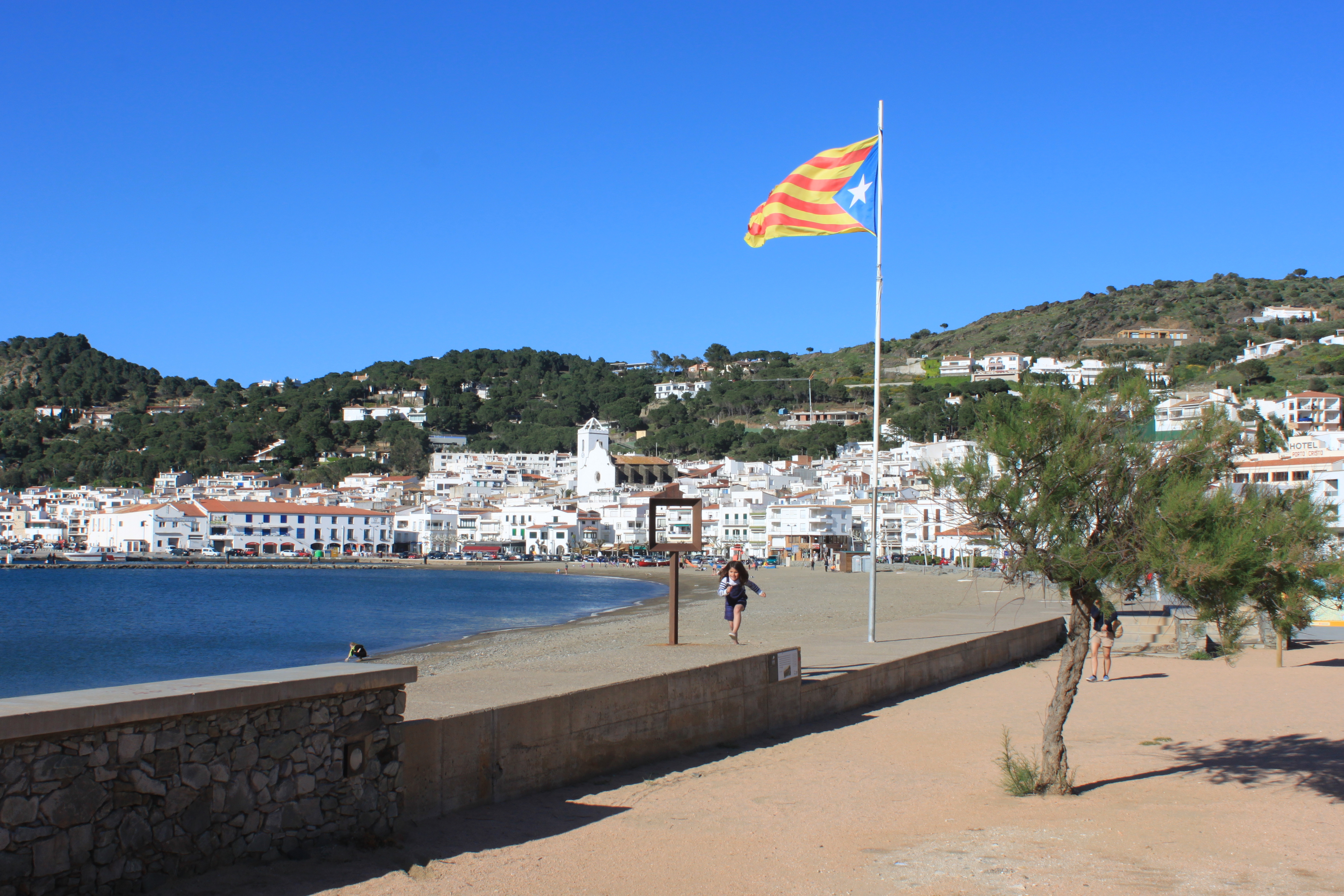
After reveling in more fantastic views, we started the parachute-drop descent to Port de la Selva (pop. 1000), losing over 2000’ of altitude in less than two miles.

The End.

Leave a comment